You are here: Home > Network List > TS - TERRAscope (Southern California Seismic Network) Stations List
> Station BAR Barrett Dam, California, USA > Earthquake Result Viewer
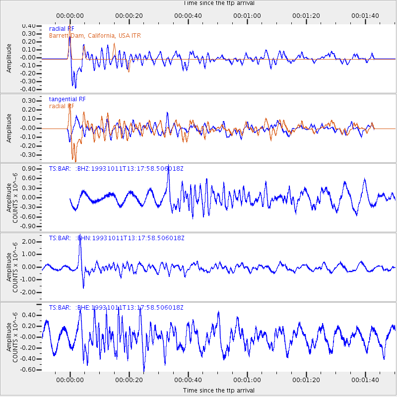
BAR Barrett Dam, California, USA - Earthquake Result Viewer
*The percent match for this event was below the threshold and hence no stack was calculated.
| Earthquake location: |
Fiji Islands Region |
| Earthquake latitude/longitude: |
-17.8/-178.8 |
| Earthquake time(UTC): |
1993/10/11 (284) 13:07:29 GMT |
| Earthquake Depth: |
556 km |
| Earthquake Magnitude: |
5.9 MB |
| Earthquake Catalog/Contributor: |
WHDF/NEIC |
|
| Network: |
TS TERRAscope (Southern California Seismic Network) |
| Station: |
BAR Barrett Dam, California, USA |
| Lat/Lon: |
32.68 N/116.67 W |
| Elevation: |
548 m |
|
| Distance: |
77.7 deg |
| Az: |
49.702 deg |
| Baz: |
239.5 deg |
| Ray Param: |
$rayparam |
*The percent match for this event was below the threshold and hence was not used in the summary stack. |
|
| Radial Match: |
64.15491 % |
| Radial Bump: |
400 |
| Transverse Match: |
56.818684 % |
| Transverse Bump: |
400 |
| SOD ConfigId: |
4480 |
| Insert Time: |
2010-02-26 14:00:47.719 +0000 |
| GWidth: |
2.5 |
| Max Bumps: |
400 |
| Tol: |
0.001 |
|
Signal To Noise
| Channel | StoN | STA | LTA |
| TS:BAR: :BHN:19931011T13:17:58.506018Z | 6.1818 | 8.7081486E-7 | 1.4086753E-7 |
| TS:BAR: :BHE:19931011T13:17:58.506018Z | 1.6733968 | 2.4085574E-7 | 1.4393224E-7 |
| TS:BAR: :BHZ:19931011T13:17:58.506018Z | 2.3774948 | 3.574405E-7 | 1.5034334E-7 |
| Arrivals |
| Ps | |
| PpPs | |
| PsPs/PpSs | |


