You are here: Home > Network List > UW - Pacific Northwest Regional Seismic Network Stations List
> Station HOOD Mt Hood Meadows, OR CREST BB SMO > Earthquake Result Viewer
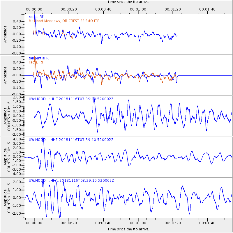
HOOD Mt Hood Meadows, OR CREST BB SMO - Earthquake Result Viewer
*The percent match for this event was below the threshold and hence no stack was calculated.
| Earthquake location: |
Solomon Islands |
| Earthquake latitude/longitude: |
-10.5/163.1 |
| Earthquake time(UTC): |
2018/11/16 (320) 03:26:55 GMT |
| Earthquake Depth: |
11 km |
| Earthquake Magnitude: |
6.2 mww |
| Earthquake Catalog/Contributor: |
NEIC PDE/us |
|
| Network: |
UW Pacific Northwest Regional Seismic Network |
| Station: |
HOOD Mt Hood Meadows, OR CREST BB SMO |
| Lat/Lon: |
45.32 N/121.65 W |
| Elevation: |
1520 m |
|
| Distance: |
87.2 deg |
| Az: |
43.076 deg |
| Baz: |
252.169 deg |
| Ray Param: |
$rayparam |
*The percent match for this event was below the threshold and hence was not used in the summary stack. |
|
| Radial Match: |
63.88067 % |
| Radial Bump: |
400 |
| Transverse Match: |
69.06379 % |
| Transverse Bump: |
359 |
| SOD ConfigId: |
13570011 |
| Insert Time: |
2019-05-01 20:21:32.657 +0000 |
| GWidth: |
2.5 |
| Max Bumps: |
400 |
| Tol: |
0.001 |
|
Signal To Noise
| Channel | StoN | STA | LTA |
| UW:HOOD: :HHZ:20181116T03:39:10.520002Z | 3.1696649 | 1.4414578E-6 | 4.5476662E-7 |
| UW:HOOD: :HHN:20181116T03:39:10.520002Z | 1.7362399 | 7.691701E-7 | 4.4300907E-7 |
| UW:HOOD: :HHE:20181116T03:39:10.520002Z | 1.3088492 | 7.2453577E-7 | 5.535671E-7 |
| Arrivals |
| Ps | |
| PpPs | |
| PsPs/PpSs | |


