You are here: Home > Network List > AZ - ANZA Regional Network Stations List
> Station LVA2 AZ.LVA2 > Earthquake Result Viewer
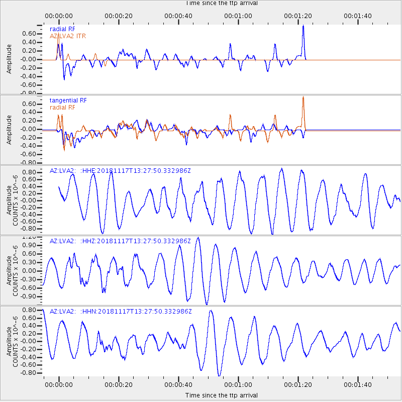
LVA2 AZ.LVA2 - Earthquake Result Viewer
*The percent match for this event was below the threshold and hence no stack was calculated.
| Earthquake location: |
North Atlantic Ocean |
| Earthquake latitude/longitude: |
15.5/-49.9 |
| Earthquake time(UTC): |
2018/11/17 (321) 13:17:59 GMT |
| Earthquake Depth: |
10 km |
| Earthquake Magnitude: |
5.5 Mww |
| Earthquake Catalog/Contributor: |
NEIC PDE/us |
|
| Network: |
AZ ANZA Regional Network |
| Station: |
LVA2 AZ.LVA2 |
| Lat/Lon: |
33.35 N/116.56 W |
| Elevation: |
1435 m |
|
| Distance: |
62.3 deg |
| Az: |
299.745 deg |
| Baz: |
89.105 deg |
| Ray Param: |
$rayparam |
*The percent match for this event was below the threshold and hence was not used in the summary stack. |
|
| Radial Match: |
59.59248 % |
| Radial Bump: |
400 |
| Transverse Match: |
59.087215 % |
| Transverse Bump: |
400 |
| SOD ConfigId: |
13570011 |
| Insert Time: |
2019-05-01 20:24:13.158 +0000 |
| GWidth: |
2.5 |
| Max Bumps: |
400 |
| Tol: |
0.001 |
|
Signal To Noise
| Channel | StoN | STA | LTA |
| AZ:LVA2: :HHZ:20181117T13:27:50.332986Z | 1.0588144 | 3.6118243E-7 | 3.411197E-7 |
| AZ:LVA2: :HHN:20181117T13:27:50.332986Z | 1.0025353 | 3.9504374E-7 | 3.9404472E-7 |
| AZ:LVA2: :HHE:20181117T13:27:50.332986Z | 0.48946446 | 2.3758213E-7 | 4.85392E-7 |
| Arrivals |
| Ps | |
| PpPs | |
| PsPs/PpSs | |


