You are here: Home > Network List > CI - Caltech Regional Seismic Network Stations List
> Station MPM Manuel Prospect Mine, California, USA > Earthquake Result Viewer
MPM Manuel Prospect Mine, California, USA - Earthquake Result Viewer
*The percent match for this event was below the threshold and hence no stack was calculated.
| Earthquake location: |
North Atlantic Ocean |
| Earthquake latitude/longitude: |
15.5/-49.9 |
| Earthquake time(UTC): |
2018/11/17 (321) 13:17:59 GMT |
| Earthquake Depth: |
10 km |
| Earthquake Magnitude: |
5.5 Mww |
| Earthquake Catalog/Contributor: |
NEIC PDE/us |
|
| Network: |
CI Caltech Regional Seismic Network |
| Station: |
MPM Manuel Prospect Mine, California, USA |
| Lat/Lon: |
36.06 N/117.49 W |
| Elevation: |
185 m |
|
| Distance: |
63.0 deg |
| Az: |
302.792 deg |
| Baz: |
89.98 deg |
| Ray Param: |
$rayparam |
*The percent match for this event was below the threshold and hence was not used in the summary stack. |
|
| Radial Match: |
33.770298 % |
| Radial Bump: |
400 |
| Transverse Match: |
47.85677 % |
| Transverse Bump: |
400 |
| SOD ConfigId: |
13570011 |
| Insert Time: |
2019-05-01 20:25:21.684 +0000 |
| GWidth: |
2.5 |
| Max Bumps: |
400 |
| Tol: |
0.001 |
|
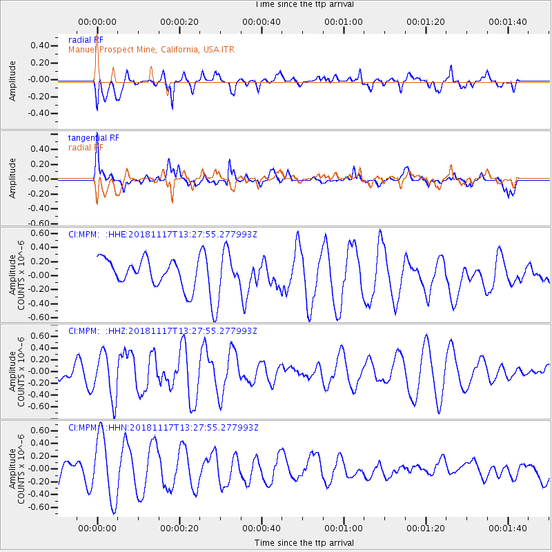
Signal To Noise
| Channel | StoN | STA | LTA |
| CI:MPM: :HHZ:20181117T13:27:55.277993Z | 2.7983272 | 3.9465198E-7 | 1.4103139E-7 |
| CI:MPM: :HHN:20181117T13:27:55.277993Z | 3.2569904 | 5.2009125E-7 | 1.5968462E-7 |
| CI:MPM: :HHE:20181117T13:27:55.277993Z | 1.61256 | 2.9781492E-7 | 1.8468454E-7 |
| Arrivals |
| Ps | |
| PpPs | |
| PsPs/PpSs | |


