You are here: Home > Network List > TA - USArray Transportable Network (new EarthScope stations) Stations List
> Station Q14A Sevier Lake (BLM), Delta, UT, USA > Earthquake Result Viewer
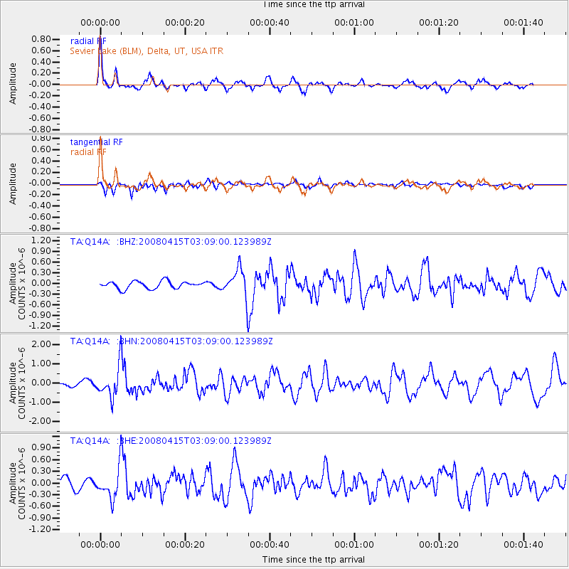
Q14A Sevier Lake (BLM), Delta, UT, USA - Earthquake Result Viewer
*The percent match for this event was below the threshold and hence no stack was calculated.
| Earthquake location: |
Near Coast Of Guatemala |
| Earthquake latitude/longitude: |
13.6/-90.6 |
| Earthquake time(UTC): |
2008/04/15 (106) 03:03:04 GMT |
| Earthquake Depth: |
33 km |
| Earthquake Magnitude: |
5.6 MB, 5.8 MS, 6.1 MW, 6.1 MW |
| Earthquake Catalog/Contributor: |
WHDF/NEIC |
|
| Network: |
TA USArray Transportable Network (new EarthScope stations) |
| Station: |
Q14A Sevier Lake (BLM), Delta, UT, USA |
| Lat/Lon: |
38.99 N/113.28 W |
| Elevation: |
1464 m |
|
| Distance: |
32.3 deg |
| Az: |
325.778 deg |
| Baz: |
135.431 deg |
| Ray Param: |
$rayparam |
*The percent match for this event was below the threshold and hence was not used in the summary stack. |
|
| Radial Match: |
75.95948 % |
| Radial Bump: |
400 |
| Transverse Match: |
63.37724 % |
| Transverse Bump: |
400 |
| SOD ConfigId: |
2504 |
| Insert Time: |
2010-03-06 18:06:16.413 +0000 |
| GWidth: |
2.5 |
| Max Bumps: |
400 |
| Tol: |
0.001 |
|
Signal To Noise
| Channel | StoN | STA | LTA |
| TA:Q14A: :BHN:20080415T03:09:00.123989Z | 8.636134 | 8.056419E-7 | 9.328733E-8 |
| TA:Q14A: :BHE:20080415T03:09:00.123989Z | 2.384026 | 3.9518142E-7 | 1.657622E-7 |
| TA:Q14A: :BHZ:20080415T03:09:00.123989Z | 4.0901685 | 4.2478695E-7 | 1.0385562E-7 |
| Arrivals |
| Ps | |
| PpPs | |
| PsPs/PpSs | |


