You are here: Home > Network List > TA - USArray Transportable Network (new EarthScope stations) Stations List
> Station F21K Alatna River, AK, USA > Earthquake Result Viewer
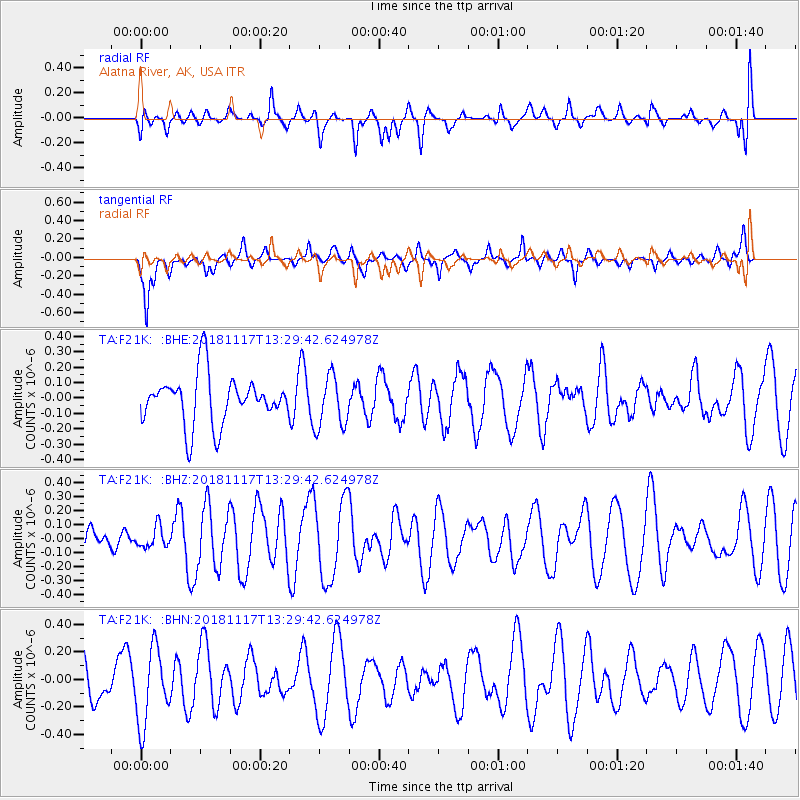
F21K Alatna River, AK, USA - Earthquake Result Viewer
*The percent match for this event was below the threshold and hence no stack was calculated.
| Earthquake location: |
North Atlantic Ocean |
| Earthquake latitude/longitude: |
15.5/-49.9 |
| Earthquake time(UTC): |
2018/11/17 (321) 13:17:59 GMT |
| Earthquake Depth: |
10 km |
| Earthquake Magnitude: |
5.5 Mww |
| Earthquake Catalog/Contributor: |
NEIC PDE/us |
|
| Network: |
TA USArray Transportable Network (new EarthScope stations) |
| Station: |
F21K Alatna River, AK, USA |
| Lat/Lon: |
67.22 N/153.48 W |
| Elevation: |
597 m |
|
| Distance: |
81.0 deg |
| Az: |
337.464 deg |
| Baz: |
71.579 deg |
| Ray Param: |
$rayparam |
*The percent match for this event was below the threshold and hence was not used in the summary stack. |
|
| Radial Match: |
50.315197 % |
| Radial Bump: |
400 |
| Transverse Match: |
69.444954 % |
| Transverse Bump: |
360 |
| SOD ConfigId: |
13570011 |
| Insert Time: |
2019-05-01 20:30:56.478 +0000 |
| GWidth: |
2.5 |
| Max Bumps: |
400 |
| Tol: |
0.001 |
|
Signal To Noise
| Channel | StoN | STA | LTA |
| TA:F21K: :BHZ:20181117T13:29:42.624978Z | 0.5735897 | 7.302114E-8 | 1.2730553E-7 |
| TA:F21K: :BHN:20181117T13:29:42.624978Z | 1.315184 | 2.7486212E-7 | 2.0899138E-7 |
| TA:F21K: :BHE:20181117T13:29:42.624978Z | 1.0570829 | 1.682825E-7 | 1.5919517E-7 |
| Arrivals |
| Ps | |
| PpPs | |
| PsPs/PpSs | |


