You are here: Home > Network List > TA - USArray Transportable Network (new EarthScope stations) Stations List
> Station J26L Joseph Creek, AK, USA > Earthquake Result Viewer
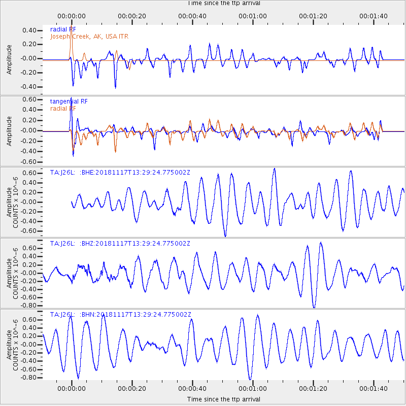
J26L Joseph Creek, AK, USA - Earthquake Result Viewer
*The percent match for this event was below the threshold and hence no stack was calculated.
| Earthquake location: |
North Atlantic Ocean |
| Earthquake latitude/longitude: |
15.5/-49.9 |
| Earthquake time(UTC): |
2018/11/17 (321) 13:17:59 GMT |
| Earthquake Depth: |
10 km |
| Earthquake Magnitude: |
5.5 Mww |
| Earthquake Catalog/Contributor: |
NEIC PDE/us |
|
| Network: |
TA USArray Transportable Network (new EarthScope stations) |
| Station: |
J26L Joseph Creek, AK, USA |
| Lat/Lon: |
64.50 N/143.56 W |
| Elevation: |
1144 m |
|
| Distance: |
77.7 deg |
| Az: |
333.759 deg |
| Baz: |
79.94 deg |
| Ray Param: |
$rayparam |
*The percent match for this event was below the threshold and hence was not used in the summary stack. |
|
| Radial Match: |
36.752026 % |
| Radial Bump: |
400 |
| Transverse Match: |
38.623764 % |
| Transverse Bump: |
400 |
| SOD ConfigId: |
13570011 |
| Insert Time: |
2019-05-01 20:31:07.982 +0000 |
| GWidth: |
2.5 |
| Max Bumps: |
400 |
| Tol: |
0.001 |
|
Signal To Noise
| Channel | StoN | STA | LTA |
| TA:J26L: :BHZ:20181117T13:29:24.775002Z | 0.56623745 | 1.4393802E-7 | 2.542008E-7 |
| TA:J26L: :BHN:20181117T13:29:24.775002Z | 2.3169348 | 5.1574517E-7 | 2.2259805E-7 |
| TA:J26L: :BHE:20181117T13:29:24.775002Z | 1.0551243 | 1.623037E-7 | 1.5382426E-7 |
| Arrivals |
| Ps | |
| PpPs | |
| PsPs/PpSs | |


