You are here: Home > Network List > TS - TERRAscope (Southern California Seismic Network) Stations List
> Station BAR Barrett Dam, California, USA > Earthquake Result Viewer
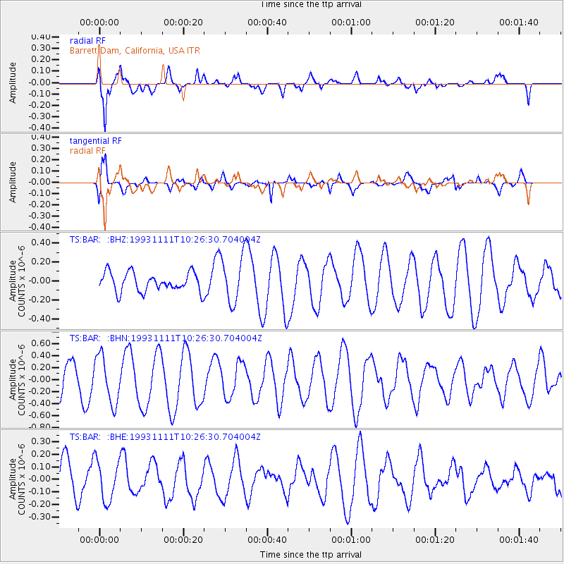
BAR Barrett Dam, California, USA - Earthquake Result Viewer
*The percent match for this event was below the threshold and hence no stack was calculated.
| Earthquake location: |
New Ireland Region, P.N.G. |
| Earthquake latitude/longitude: |
-4.6/153.1 |
| Earthquake time(UTC): |
1993/11/11 (315) 10:13:59 GMT |
| Earthquake Depth: |
80 km |
| Earthquake Magnitude: |
5.7 MB |
| Earthquake Catalog/Contributor: |
WHDF/NEIC |
|
| Network: |
TS TERRAscope (Southern California Seismic Network) |
| Station: |
BAR Barrett Dam, California, USA |
| Lat/Lon: |
32.68 N/116.67 W |
| Elevation: |
548 m |
|
| Distance: |
92.6 deg |
| Az: |
57.59 deg |
| Baz: |
266.302 deg |
| Ray Param: |
$rayparam |
*The percent match for this event was below the threshold and hence was not used in the summary stack. |
|
| Radial Match: |
87.84399 % |
| Radial Bump: |
400 |
| Transverse Match: |
78.02666 % |
| Transverse Bump: |
400 |
| SOD ConfigId: |
4480 |
| Insert Time: |
2010-02-26 14:00:51.687 +0000 |
| GWidth: |
2.5 |
| Max Bumps: |
400 |
| Tol: |
0.001 |
|
Signal To Noise
| Channel | StoN | STA | LTA |
| TS:BAR: :BHN:19931111T10:26:30.704004Z | 1.8585517 | 4.0938977E-7 | 2.2027355E-7 |
| TS:BAR: :BHE:19931111T10:26:30.704004Z | 0.9818149 | 1.5895384E-7 | 1.6189797E-7 |
| TS:BAR: :BHZ:19931111T10:26:30.704004Z | 2.497792 | 2.4766857E-7 | 9.9155E-8 |
| Arrivals |
| Ps | |
| PpPs | |
| PsPs/PpSs | |


