You are here: Home > Network List > TA - USArray Transportable Network (new EarthScope stations) Stations List
> Station S16A Weppner Ranch, Escalante, UT, USA > Earthquake Result Viewer
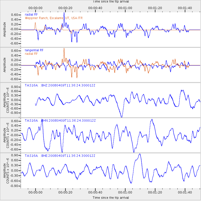
S16A Weppner Ranch, Escalante, UT, USA - Earthquake Result Viewer
*The percent match for this event was below the threshold and hence no stack was calculated.
| Earthquake location: |
Loyalty Islands |
| Earthquake latitude/longitude: |
-20.2/168.9 |
| Earthquake time(UTC): |
2008/04/09 (100) 11:23:40 GMT |
| Earthquake Depth: |
35 km |
| Earthquake Magnitude: |
5.7 MB, 6.3 MW, 6.3 MW |
| Earthquake Catalog/Contributor: |
WHDF/NEIC |
|
| Network: |
TA USArray Transportable Network (new EarthScope stations) |
| Station: |
S16A Weppner Ranch, Escalante, UT, USA |
| Lat/Lon: |
37.72 N/111.60 W |
| Elevation: |
1785 m |
|
| Distance: |
94.2 deg |
| Az: |
51.425 deg |
| Baz: |
247.832 deg |
| Ray Param: |
$rayparam |
*The percent match for this event was below the threshold and hence was not used in the summary stack. |
|
| Radial Match: |
64.84799 % |
| Radial Bump: |
343 |
| Transverse Match: |
56.200974 % |
| Transverse Bump: |
355 |
| SOD ConfigId: |
2504 |
| Insert Time: |
2010-03-06 18:09:14.731 +0000 |
| GWidth: |
2.5 |
| Max Bumps: |
400 |
| Tol: |
0.001 |
|
Signal To Noise
| Channel | StoN | STA | LTA |
| TA:S16A: :BHN:20080409T11:36:24.300012Z | 2.5562904 | 3.421638E-7 | 1.3385169E-7 |
| TA:S16A: :BHE:20080409T11:36:24.300012Z | 1.2400157 | 1.7325537E-7 | 1.397203E-7 |
| TA:S16A: :BHZ:20080409T11:36:24.300012Z | 1.1882505 | 2.3294021E-7 | 1.9603628E-7 |
| Arrivals |
| Ps | |
| PpPs | |
| PsPs/PpSs | |


