You are here: Home > Network List > TS - TERRAscope (Southern California Seismic Network) Stations List
> Station BAR Barrett Dam, California, USA > Earthquake Result Viewer
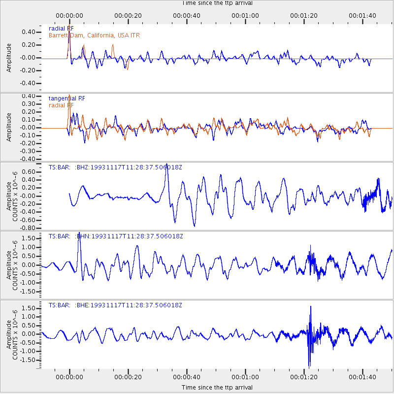
BAR Barrett Dam, California, USA - Earthquake Result Viewer
*The percent match for this event was below the threshold and hence no stack was calculated.
| Earthquake location: |
Near East Coast Of Kamchatka |
| Earthquake latitude/longitude: |
51.8/158.7 |
| Earthquake time(UTC): |
1993/11/17 (321) 11:18:52 GMT |
| Earthquake Depth: |
44 km |
| Earthquake Magnitude: |
6.0 MB, 5.6 MS |
| Earthquake Catalog/Contributor: |
WHDF/NEIC |
|
| Network: |
TS TERRAscope (Southern California Seismic Network) |
| Station: |
BAR Barrett Dam, California, USA |
| Lat/Lon: |
32.68 N/116.67 W |
| Elevation: |
548 m |
|
| Distance: |
61.9 deg |
| Az: |
72.065 deg |
| Baz: |
315.536 deg |
| Ray Param: |
$rayparam |
*The percent match for this event was below the threshold and hence was not used in the summary stack. |
|
| Radial Match: |
54.265495 % |
| Radial Bump: |
400 |
| Transverse Match: |
73.09899 % |
| Transverse Bump: |
400 |
| SOD ConfigId: |
4480 |
| Insert Time: |
2010-02-26 14:00:54.366 +0000 |
| GWidth: |
2.5 |
| Max Bumps: |
400 |
| Tol: |
0.001 |
|
Signal To Noise
| Channel | StoN | STA | LTA |
| TS:BAR: :BHN:19931117T11:28:37.506018Z | 5.305251 | 7.079623E-7 | 1.3344558E-7 |
| TS:BAR: :BHE:19931117T11:28:37.506018Z | 0.862981 | 2.5333762E-7 | 2.9356107E-7 |
| TS:BAR: :BHZ:19931117T11:28:37.506018Z | 3.4999435 | 3.3059462E-7 | 9.445713E-8 |
| Arrivals |
| Ps | |
| PpPs | |
| PsPs/PpSs | |


