You are here: Home > Network List > TA - USArray Transportable Network (new EarthScope stations) Stations List
> Station M31M Drury Creek, Yukon, CA > Earthquake Result Viewer
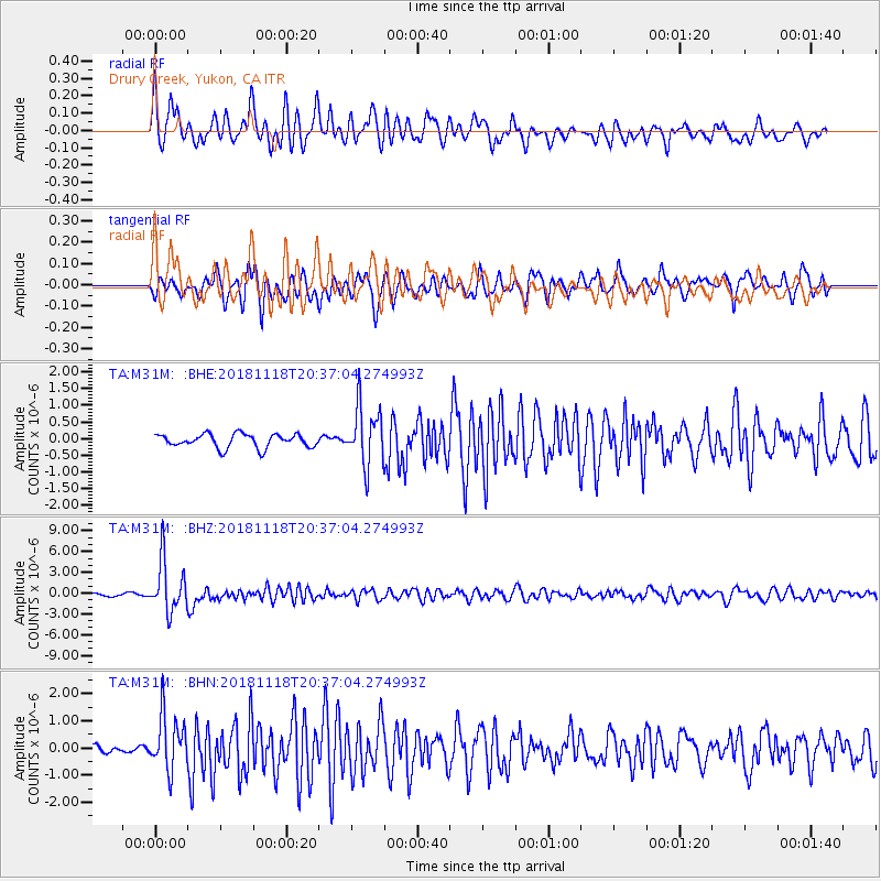
M31M Drury Creek, Yukon, CA - Earthquake Result Viewer
*The percent match for this event was below the threshold and hence no stack was calculated.
| Earthquake location: |
Fiji Islands Region |
| Earthquake latitude/longitude: |
-17.9/-178.9 |
| Earthquake time(UTC): |
2018/11/18 (322) 20:25:45 GMT |
| Earthquake Depth: |
534 km |
| Earthquake Magnitude: |
6.7 Mww |
| Earthquake Catalog/Contributor: |
NEIC PDE/us |
|
| Network: |
TA USArray Transportable Network (new EarthScope stations) |
| Station: |
M31M Drury Creek, Yukon, CA |
| Lat/Lon: |
62.20 N/134.39 W |
| Elevation: |
639 m |
|
| Distance: |
87.2 deg |
| Az: |
19.21 deg |
| Baz: |
221.937 deg |
| Ray Param: |
$rayparam |
*The percent match for this event was below the threshold and hence was not used in the summary stack. |
|
| Radial Match: |
76.68588 % |
| Radial Bump: |
400 |
| Transverse Match: |
81.27098 % |
| Transverse Bump: |
400 |
| SOD ConfigId: |
13570011 |
| Insert Time: |
2019-05-01 20:46:00.177 +0000 |
| GWidth: |
2.5 |
| Max Bumps: |
400 |
| Tol: |
0.001 |
|
Signal To Noise
| Channel | StoN | STA | LTA |
| TA:M31M: :BHZ:20181118T20:37:04.274993Z | 17.17012 | 3.6773615E-6 | 2.1417215E-7 |
| TA:M31M: :BHN:20181118T20:37:04.274993Z | 7.9518356 | 1.0103618E-6 | 1.270602E-7 |
| TA:M31M: :BHE:20181118T20:37:04.274993Z | 4.309361 | 8.736646E-7 | 2.0273646E-7 |
| Arrivals |
| Ps | |
| PpPs | |
| PsPs/PpSs | |


