You are here: Home > Network List > TS - TERRAscope (Southern California Seismic Network) Stations List
> Station BAR Barrett Dam, California, USA > Earthquake Result Viewer
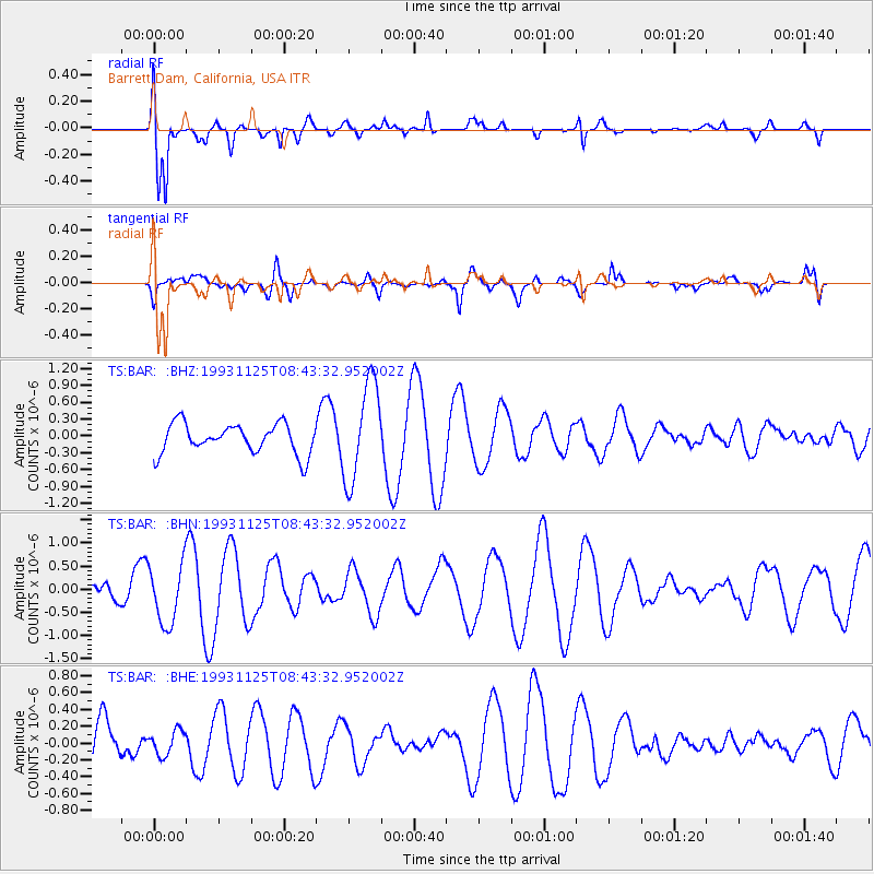
BAR Barrett Dam, California, USA - Earthquake Result Viewer
*The percent match for this event was below the threshold and hence no stack was calculated.
| Earthquake location: |
Southeast Of Loyalty Islands |
| Earthquake latitude/longitude: |
-22.0/170.1 |
| Earthquake time(UTC): |
1993/11/25 (329) 08:31:14 GMT |
| Earthquake Depth: |
33 km |
| Earthquake Magnitude: |
5.7 MB, 5.7 MS, 5.5 UNKNOWN |
| Earthquake Catalog/Contributor: |
WHDF/NEIC |
|
| Network: |
TS TERRAscope (Southern California Seismic Network) |
| Station: |
BAR Barrett Dam, California, USA |
| Lat/Lon: |
32.68 N/116.67 W |
| Elevation: |
548 m |
|
| Distance: |
88.5 deg |
| Az: |
53.884 deg |
| Baz: |
242.751 deg |
| Ray Param: |
$rayparam |
*The percent match for this event was below the threshold and hence was not used in the summary stack. |
|
| Radial Match: |
77.7336 % |
| Radial Bump: |
400 |
| Transverse Match: |
33.982887 % |
| Transverse Bump: |
400 |
| SOD ConfigId: |
4480 |
| Insert Time: |
2010-02-26 14:00:55.215 +0000 |
| GWidth: |
2.5 |
| Max Bumps: |
400 |
| Tol: |
0.001 |
|
Signal To Noise
| Channel | StoN | STA | LTA |
| TS:BAR: :BHN:19931125T08:43:32.952002Z | 2.2585247 | 6.524853E-7 | 2.888989E-7 |
| TS:BAR: :BHE:19931125T08:43:32.952002Z | 0.30294693 | 1.4398604E-7 | 4.752847E-7 |
| TS:BAR: :BHZ:19931125T08:43:32.952002Z | 3.3246965 | 8.8237573E-7 | 2.654004E-7 |
| Arrivals |
| Ps | |
| PpPs | |
| PsPs/PpSs | |


