You are here: Home > Network List > UW - Pacific Northwest Regional Seismic Network Stations List
> Station FISH Seaside, OR, USA > Earthquake Result Viewer
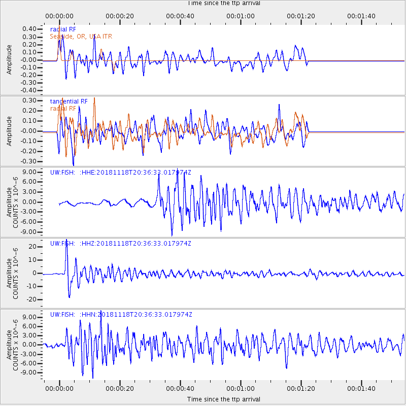
FISH Seaside, OR, USA - Earthquake Result Viewer
*The percent match for this event was below the threshold and hence no stack was calculated.
| Earthquake location: |
Fiji Islands Region |
| Earthquake latitude/longitude: |
-17.9/-178.9 |
| Earthquake time(UTC): |
2018/11/18 (322) 20:25:45 GMT |
| Earthquake Depth: |
534 km |
| Earthquake Magnitude: |
6.7 Mww |
| Earthquake Catalog/Contributor: |
NEIC PDE/us |
|
| Network: |
UW Pacific Northwest Regional Seismic Network |
| Station: |
FISH Seaside, OR, USA |
| Lat/Lon: |
45.93 N/123.56 W |
| Elevation: |
325 m |
|
| Distance: |
80.8 deg |
| Az: |
35.556 deg |
| Baz: |
232.5 deg |
| Ray Param: |
$rayparam |
*The percent match for this event was below the threshold and hence was not used in the summary stack. |
|
| Radial Match: |
77.34859 % |
| Radial Bump: |
400 |
| Transverse Match: |
81.06943 % |
| Transverse Bump: |
400 |
| SOD ConfigId: |
13570011 |
| Insert Time: |
2019-05-01 20:47:56.093 +0000 |
| GWidth: |
2.5 |
| Max Bumps: |
400 |
| Tol: |
0.001 |
|
Signal To Noise
| Channel | StoN | STA | LTA |
| UW:FISH: :HHZ:20181118T20:36:33.017974Z | 18.491915 | 9.230894E-6 | 4.991854E-7 |
| UW:FISH: :HHN:20181118T20:36:33.017974Z | 5.746075 | 2.521403E-6 | 4.3880442E-7 |
| UW:FISH: :HHE:20181118T20:36:33.017974Z | 4.791783 | 2.6212467E-6 | 5.470295E-7 |
| Arrivals |
| Ps | |
| PpPs | |
| PsPs/PpSs | |


