You are here: Home > Network List > TA - USArray Transportable Network (new EarthScope stations) Stations List
> Station J20K Nowitna River, AK, USA > Earthquake Result Viewer
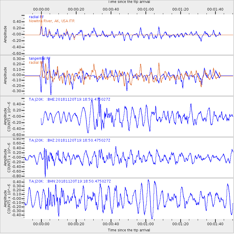
J20K Nowitna River, AK, USA - Earthquake Result Viewer
*The percent match for this event was below the threshold and hence no stack was calculated.
| Earthquake location: |
Kyushu, Japan |
| Earthquake latitude/longitude: |
30.4/130.1 |
| Earthquake time(UTC): |
2018/11/20 (324) 19:09:48 GMT |
| Earthquake Depth: |
123 km |
| Earthquake Magnitude: |
5.5 Mww |
| Earthquake Catalog/Contributor: |
NEIC PDE/us |
|
| Network: |
TA USArray Transportable Network (new EarthScope stations) |
| Station: |
J20K Nowitna River, AK, USA |
| Lat/Lon: |
64.18 N/154.15 W |
| Elevation: |
314 m |
|
| Distance: |
56.9 deg |
| Az: |
30.44 deg |
| Baz: |
272.042 deg |
| Ray Param: |
$rayparam |
*The percent match for this event was below the threshold and hence was not used in the summary stack. |
|
| Radial Match: |
45.130074 % |
| Radial Bump: |
400 |
| Transverse Match: |
47.444206 % |
| Transverse Bump: |
379 |
| SOD ConfigId: |
13570011 |
| Insert Time: |
2019-05-01 20:56:46.862 +0000 |
| GWidth: |
2.5 |
| Max Bumps: |
400 |
| Tol: |
0.001 |
|
Signal To Noise
| Channel | StoN | STA | LTA |
| TA:J20K: :BHZ:20181120T19:18:50.475027Z | 2.0318708 | 2.5271154E-7 | 1.2437383E-7 |
| TA:J20K: :BHN:20181120T19:18:50.475027Z | 0.9274011 | 1.6307165E-7 | 1.7583723E-7 |
| TA:J20K: :BHE:20181120T19:18:50.475027Z | 2.3701036 | 3.3437985E-7 | 1.4108238E-7 |
| Arrivals |
| Ps | |
| PpPs | |
| PsPs/PpSs | |


