You are here: Home > Network List > US - United States National Seismic Network Stations List
> Station EGMT Eagleton, Montana, USA > Earthquake Result Viewer
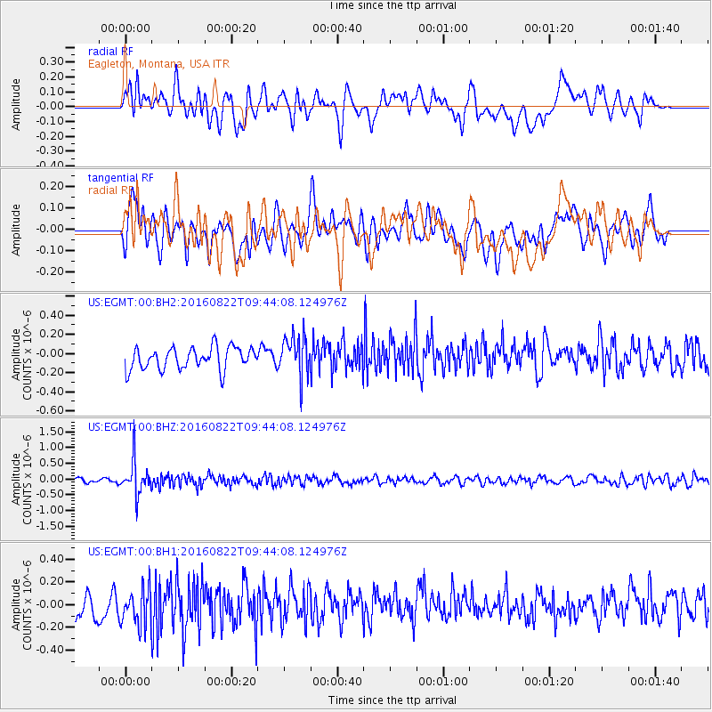
EGMT Eagleton, Montana, USA - Earthquake Result Viewer
*The percent match for this event was below the threshold and hence no stack was calculated.
| Earthquake location: |
Southeast Of Honshu, Japan |
| Earthquake latitude/longitude: |
29.9/139.1 |
| Earthquake time(UTC): |
2016/08/22 (235) 09:33:08 GMT |
| Earthquake Depth: |
404 km |
| Earthquake Magnitude: |
5.6 MB |
| Earthquake Catalog/Contributor: |
NEIC PDE/NEIC COMCAT |
|
| Network: |
US United States National Seismic Network |
| Station: |
EGMT Eagleton, Montana, USA |
| Lat/Lon: |
48.02 N/109.75 W |
| Elevation: |
1055 m |
|
| Distance: |
80.9 deg |
| Az: |
39.357 deg |
| Baz: |
304.883 deg |
| Ray Param: |
$rayparam |
*The percent match for this event was below the threshold and hence was not used in the summary stack. |
|
| Radial Match: |
56.70357 % |
| Radial Bump: |
400 |
| Transverse Match: |
59.110058 % |
| Transverse Bump: |
400 |
| SOD ConfigId: |
1634031 |
| Insert Time: |
2016-09-05 09:36:35.966 +0000 |
| GWidth: |
2.5 |
| Max Bumps: |
400 |
| Tol: |
0.001 |
|
Signal To Noise
| Channel | StoN | STA | LTA |
| US:EGMT:00:BHZ:20160822T09:44:08.124976Z | 8.063773 | 5.506092E-7 | 6.828182E-8 |
| US:EGMT:00:BH1:20160822T09:44:08.124976Z | 1.6875132 | 1.6605387E-7 | 9.840152E-8 |
| US:EGMT:00:BH2:20160822T09:44:08.124976Z | 1.8126782 | 2.0990423E-7 | 1.15797846E-7 |
| Arrivals |
| Ps | |
| PpPs | |
| PsPs/PpSs | |


