You are here: Home > Network List > AZ - ANZA Regional Network Stations List
> Station FRD AZ.FRD > Earthquake Result Viewer
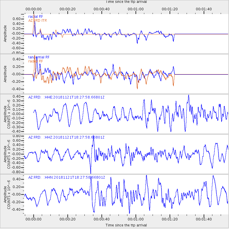
FRD AZ.FRD - Earthquake Result Viewer
*The percent match for this event was below the threshold and hence no stack was calculated.
| Earthquake location: |
Southern Alaska |
| Earthquake latitude/longitude: |
60.0/-153.3 |
| Earthquake time(UTC): |
2018/11/21 (325) 18:21:43 GMT |
| Earthquake Depth: |
146 km |
| Earthquake Magnitude: |
5.7 Ml |
| Earthquake Catalog/Contributor: |
NEIC PDE/ak |
|
| Network: |
AZ ANZA Regional Network |
| Station: |
FRD AZ.FRD |
| Lat/Lon: |
33.49 N/116.60 W |
| Elevation: |
1164 m |
|
| Distance: |
35.7 deg |
| Az: |
121.226 deg |
| Baz: |
329.025 deg |
| Ray Param: |
$rayparam |
*The percent match for this event was below the threshold and hence was not used in the summary stack. |
|
| Radial Match: |
58.776752 % |
| Radial Bump: |
400 |
| Transverse Match: |
61.029526 % |
| Transverse Bump: |
400 |
| SOD ConfigId: |
13570011 |
| Insert Time: |
2019-05-01 20:59:01.935 +0000 |
| GWidth: |
2.5 |
| Max Bumps: |
400 |
| Tol: |
0.001 |
|
Signal To Noise
| Channel | StoN | STA | LTA |
| AZ:FRD: :HHZ:20181121T18:27:58.66801Z | 0.98213625 | 1.6983448E-7 | 1.7292354E-7 |
| AZ:FRD: :HHN:20181121T18:27:58.66801Z | 2.080045 | 2.0981179E-7 | 1.00868874E-7 |
| AZ:FRD: :HHE:20181121T18:27:58.66801Z | 1.2937773 | 1.854464E-7 | 1.4333719E-7 |
| Arrivals |
| Ps | |
| PpPs | |
| PsPs/PpSs | |


