You are here: Home > Network List > TS - TERRAscope (Southern California Seismic Network) Stations List
> Station BAR Barrett Dam, California, USA > Earthquake Result Viewer
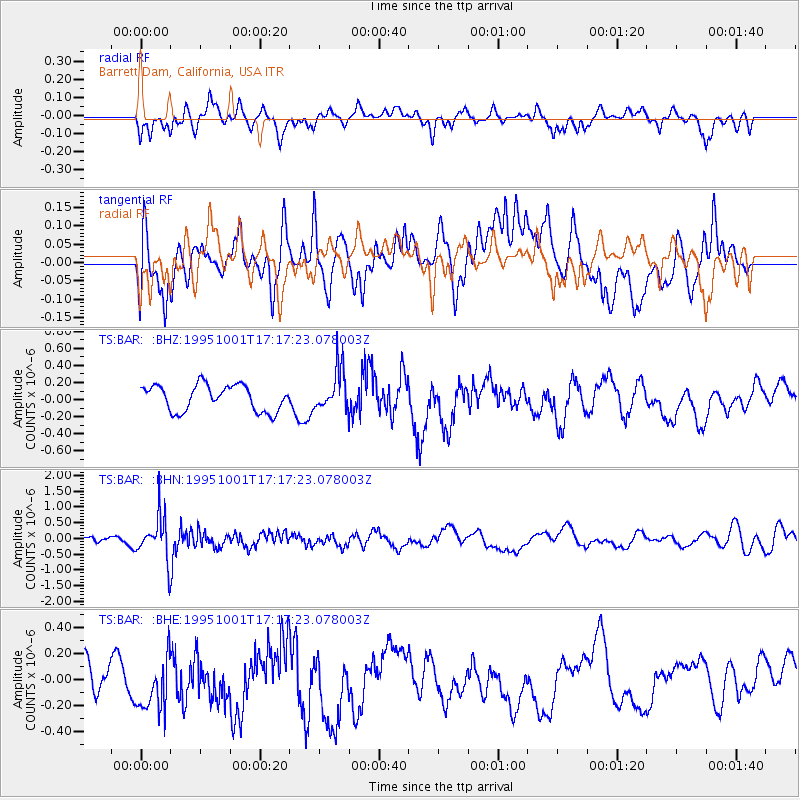
BAR Barrett Dam, California, USA - Earthquake Result Viewer
*The percent match for this event was below the threshold and hence no stack was calculated.
| Earthquake location: |
Southeast Of Honshu, Japan |
| Earthquake latitude/longitude: |
29.3/139.0 |
| Earthquake time(UTC): |
1995/10/01 (274) 17:06:03 GMT |
| Earthquake Depth: |
427 km |
| Earthquake Magnitude: |
5.5 MB, 5.8 UNKNOWN, 6.1 MW |
| Earthquake Catalog/Contributor: |
WHDF/NEIC |
|
| Network: |
TS TERRAscope (Southern California Seismic Network) |
| Station: |
BAR Barrett Dam, California, USA |
| Lat/Lon: |
32.68 N/116.67 W |
| Elevation: |
548 m |
|
| Distance: |
85.5 deg |
| Az: |
55.034 deg |
| Baz: |
301.934 deg |
| Ray Param: |
$rayparam |
*The percent match for this event was below the threshold and hence was not used in the summary stack. |
|
| Radial Match: |
51.359306 % |
| Radial Bump: |
400 |
| Transverse Match: |
62.922924 % |
| Transverse Bump: |
400 |
| SOD ConfigId: |
4480 |
| Insert Time: |
2010-02-26 14:00:58.770 +0000 |
| GWidth: |
2.5 |
| Max Bumps: |
400 |
| Tol: |
0.001 |
|
Signal To Noise
| Channel | StoN | STA | LTA |
| TS:BAR: :BHN:19951001T17:17:23.078003Z | 2.4630256 | 7.0169597E-7 | 2.8489185E-7 |
| TS:BAR: :BHE:19951001T17:17:23.078003Z | 1.1533624 | 2.3684204E-7 | 2.0534921E-7 |
| TS:BAR: :BHZ:19951001T17:17:23.078003Z | 1.6003232 | 2.4102894E-7 | 1.5061268E-7 |
| Arrivals |
| Ps | |
| PpPs | |
| PsPs/PpSs | |


