You are here: Home > Network List > TA - USArray Transportable Network (new EarthScope stations) Stations List
> Station H16K Elim, AK, USA > Earthquake Result Viewer
H16K Elim, AK, USA - Earthquake Result Viewer
*The percent match for this event was below the threshold and hence no stack was calculated.
| Earthquake location: |
Caribbean Sea |
| Earthquake latitude/longitude: |
13.2/-81.2 |
| Earthquake time(UTC): |
2018/11/25 (329) 03:40:51 GMT |
| Earthquake Depth: |
10 km |
| Earthquake Magnitude: |
6.0 Mww |
| Earthquake Catalog/Contributor: |
NEIC PDE/us |
|
| Network: |
TA USArray Transportable Network (new EarthScope stations) |
| Station: |
H16K Elim, AK, USA |
| Lat/Lon: |
64.64 N/162.24 W |
| Elevation: |
216 m |
|
| Distance: |
74.4 deg |
| Az: |
333.782 deg |
| Baz: |
92.315 deg |
| Ray Param: |
$rayparam |
*The percent match for this event was below the threshold and hence was not used in the summary stack. |
|
| Radial Match: |
55.054955 % |
| Radial Bump: |
400 |
| Transverse Match: |
57.412067 % |
| Transverse Bump: |
400 |
| SOD ConfigId: |
13570011 |
| Insert Time: |
2019-05-01 21:27:00.606 +0000 |
| GWidth: |
2.5 |
| Max Bumps: |
400 |
| Tol: |
0.001 |
|
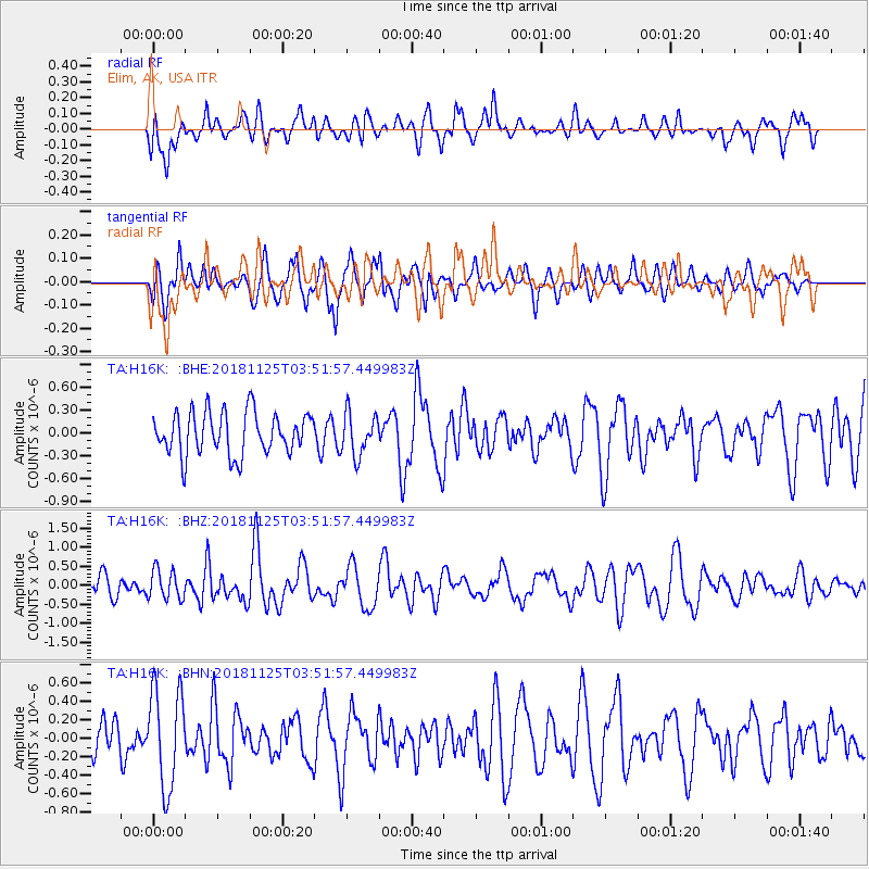
Signal To Noise
| Channel | StoN | STA | LTA |
| TA:H16K: :BHZ:20181125T03:51:57.449983Z | 1.4464213 | 3.869123E-7 | 2.6749626E-7 |
| TA:H16K: :BHN:20181125T03:51:57.449983Z | 2.621911 | 5.3395036E-7 | 2.0364932E-7 |
| TA:H16K: :BHE:20181125T03:51:57.449983Z | 0.9829751 | 2.743725E-7 | 2.7912458E-7 |
| Arrivals |
| Ps | |
| PpPs | |
| PsPs/PpSs | |


