You are here: Home > Network List > TA - USArray Transportable Network (new EarthScope stations) Stations List
> Station E12A Beaver Dam Saddle, Pierce, ID, USA > Earthquake Result Viewer
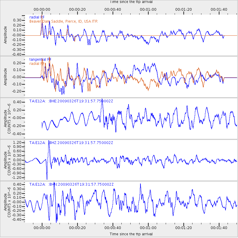
E12A Beaver Dam Saddle, Pierce, ID, USA - Earthquake Result Viewer
*The percent match for this event was below the threshold and hence no stack was calculated.
| Earthquake location: |
Northwest Of Ryukyu Islands |
| Earthquake latitude/longitude: |
27.4/126.7 |
| Earthquake time(UTC): |
2009/03/26 (085) 19:19:59 GMT |
| Earthquake Depth: |
160 km |
| Earthquake Magnitude: |
5.6 MB, 5.9 MW, 5.9 MW |
| Earthquake Catalog/Contributor: |
WHDF/NEIC |
|
| Network: |
TA USArray Transportable Network (new EarthScope stations) |
| Station: |
E12A Beaver Dam Saddle, Pierce, ID, USA |
| Lat/Lon: |
46.42 N/115.57 W |
| Elevation: |
1555 m |
|
| Distance: |
87.4 deg |
| Az: |
37.808 deg |
| Baz: |
308.033 deg |
| Ray Param: |
$rayparam |
*The percent match for this event was below the threshold and hence was not used in the summary stack. |
|
| Radial Match: |
47.16872 % |
| Radial Bump: |
400 |
| Transverse Match: |
59.62435 % |
| Transverse Bump: |
400 |
| SOD ConfigId: |
2658 |
| Insert Time: |
2010-03-06 18:12:38.116 +0000 |
| GWidth: |
2.5 |
| Max Bumps: |
400 |
| Tol: |
0.001 |
|
Signal To Noise
| Channel | StoN | STA | LTA |
| TA:E12A: :BHZ:20090326T19:31:57.750002Z | 4.8950996 | 5.2545215E-7 | 1.0734249E-7 |
| TA:E12A: :BHN:20090326T19:31:57.750002Z | 1.9995931 | 1.7763223E-7 | 8.883419E-8 |
| TA:E12A: :BHE:20090326T19:31:57.750002Z | 1.9900681 | 2.1918162E-7 | 1.1013775E-7 |
| Arrivals |
| Ps | |
| PpPs | |
| PsPs/PpSs | |


