You are here: Home > Network List > TA - USArray Transportable Network (new EarthScope stations) Stations List
> Station B22K Teshekpuk Lake, AK, USA > Earthquake Result Viewer
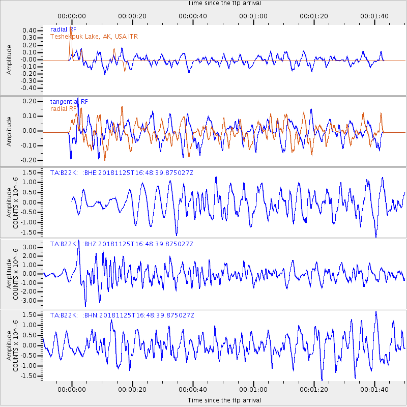
B22K Teshekpuk Lake, AK, USA - Earthquake Result Viewer
*The percent match for this event was below the threshold and hence no stack was calculated.
| Earthquake location: |
Iran-Iraq Border Region |
| Earthquake latitude/longitude: |
34.3/45.7 |
| Earthquake time(UTC): |
2018/11/25 (329) 16:37:31 GMT |
| Earthquake Depth: |
10 km |
| Earthquake Magnitude: |
6.3 Mww |
| Earthquake Catalog/Contributor: |
NEIC PDE/us |
|
| Network: |
TA USArray Transportable Network (new EarthScope stations) |
| Station: |
B22K Teshekpuk Lake, AK, USA |
| Lat/Lon: |
70.34 N/153.42 W |
| Elevation: |
50 m |
|
| Distance: |
74.7 deg |
| Az: |
6.612 deg |
| Baz: |
343.643 deg |
| Ray Param: |
$rayparam |
*The percent match for this event was below the threshold and hence was not used in the summary stack. |
|
| Radial Match: |
61.595135 % |
| Radial Bump: |
400 |
| Transverse Match: |
45.653034 % |
| Transverse Bump: |
400 |
| SOD ConfigId: |
13570011 |
| Insert Time: |
2019-05-01 21:42:46.960 +0000 |
| GWidth: |
2.5 |
| Max Bumps: |
400 |
| Tol: |
0.001 |
|
Signal To Noise
| Channel | StoN | STA | LTA |
| TA:B22K: :BHZ:20181125T16:48:39.875027Z | 5.012236 | 1.6837001E-6 | 3.3591797E-7 |
| TA:B22K: :BHN:20181125T16:48:39.875027Z | 0.8031165 | 2.6469866E-7 | 3.2958937E-7 |
| TA:B22K: :BHE:20181125T16:48:39.875027Z | 1.9403436 | 7.914151E-7 | 4.0787367E-7 |
| Arrivals |
| Ps | |
| PpPs | |
| PsPs/PpSs | |


