You are here: Home > Network List > G - GEOSCOPE Stations List
> Station RER Riviere de l'Est, La Reunion (Indian Ocean) > Earthquake Result Viewer
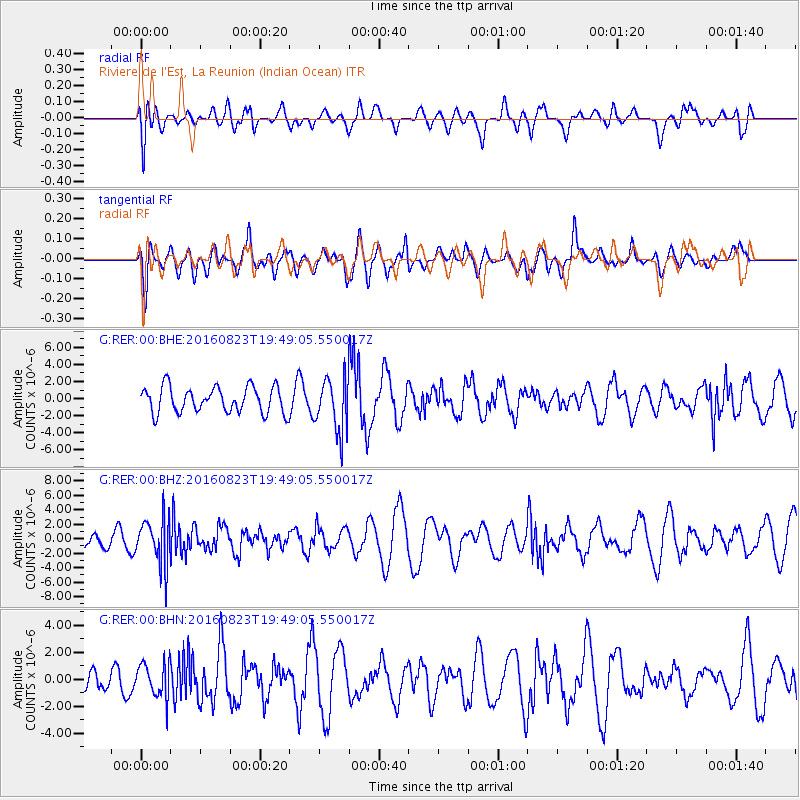
RER Riviere de l'Est, La Reunion (Indian Ocean) - Earthquake Result Viewer
*The percent match for this event was below the threshold and hence no stack was calculated.
| Earthquake location: |
Flores Sea |
| Earthquake latitude/longitude: |
-7.3/122.5 |
| Earthquake time(UTC): |
2016/08/23 (236) 19:39:44 GMT |
| Earthquake Depth: |
528 km |
| Earthquake Magnitude: |
6.0 MB |
| Earthquake Catalog/Contributor: |
NEIC PDE/NEIC COMCAT |
|
| Network: |
G GEOSCOPE |
| Station: |
RER Riviere de l'Est, La Reunion (Indian Ocean) |
| Lat/Lon: |
21.16 S/55.75 E |
| Elevation: |
834 m |
|
| Distance: |
65.7 deg |
| Az: |
250.149 deg |
| Baz: |
88.539 deg |
| Ray Param: |
$rayparam |
*The percent match for this event was below the threshold and hence was not used in the summary stack. |
|
| Radial Match: |
30.900232 % |
| Radial Bump: |
400 |
| Transverse Match: |
45.620598 % |
| Transverse Bump: |
400 |
| SOD ConfigId: |
1634031 |
| Insert Time: |
2016-09-06 19:40:20.381 +0000 |
| GWidth: |
2.5 |
| Max Bumps: |
400 |
| Tol: |
0.001 |
|
Signal To Noise
| Channel | StoN | STA | LTA |
| G:RER:00:BHZ:20160823T19:49:05.550017Z | 1.8098314 | 3.1734944E-6 | 1.7534752E-6 |
| G:RER:00:BHN:20160823T19:49:05.550017Z | 0.7418483 | 1.311202E-6 | 1.76748E-6 |
| G:RER:00:BHE:20160823T19:49:05.550017Z | 2.0692868 | 3.0928334E-6 | 1.4946373E-6 |
| Arrivals |
| Ps | |
| PpPs | |
| PsPs/PpSs | |


