You are here: Home > Network List > TA - USArray Transportable Network (new EarthScope stations) Stations List
> Station G21K Allakaket, AK, USA > Earthquake Result Viewer
G21K Allakaket, AK, USA - Earthquake Result Viewer
*The percent match for this event was below the threshold and hence no stack was calculated.
| Earthquake location: |
Iran-Iraq Border Region |
| Earthquake latitude/longitude: |
34.3/45.7 |
| Earthquake time(UTC): |
2018/11/25 (329) 16:37:31 GMT |
| Earthquake Depth: |
10 km |
| Earthquake Magnitude: |
6.3 Mww |
| Earthquake Catalog/Contributor: |
NEIC PDE/us |
|
| Network: |
TA USArray Transportable Network (new EarthScope stations) |
| Station: |
G21K Allakaket, AK, USA |
| Lat/Lon: |
66.52 N/153.51 W |
| Elevation: |
446 m |
|
| Distance: |
78.4 deg |
| Az: |
7.75 deg |
| Baz: |
343.827 deg |
| Ray Param: |
$rayparam |
*The percent match for this event was below the threshold and hence was not used in the summary stack. |
|
| Radial Match: |
67.15941 % |
| Radial Bump: |
400 |
| Transverse Match: |
63.654854 % |
| Transverse Bump: |
400 |
| SOD ConfigId: |
13570011 |
| Insert Time: |
2019-05-01 21:43:26.667 +0000 |
| GWidth: |
2.5 |
| Max Bumps: |
400 |
| Tol: |
0.001 |
|
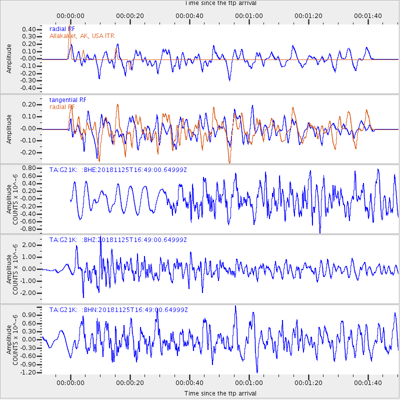
Signal To Noise
| Channel | StoN | STA | LTA |
| TA:G21K: :BHZ:20181125T16:49:00.64999Z | 8.327065 | 8.5886523E-7 | 1.0314141E-7 |
| TA:G21K: :BHN:20181125T16:49:00.64999Z | 2.3803203 | 4.3087272E-7 | 1.810146E-7 |
| TA:G21K: :BHE:20181125T16:49:00.64999Z | 0.7464382 | 1.9577256E-7 | 2.6227562E-7 |
| Arrivals |
| Ps | |
| PpPs | |
| PsPs/PpSs | |


