You are here: Home > Network List > TA - USArray Transportable Network (new EarthScope stations) Stations List
> Station P17K Kvichak River, AK, USA > Earthquake Result Viewer
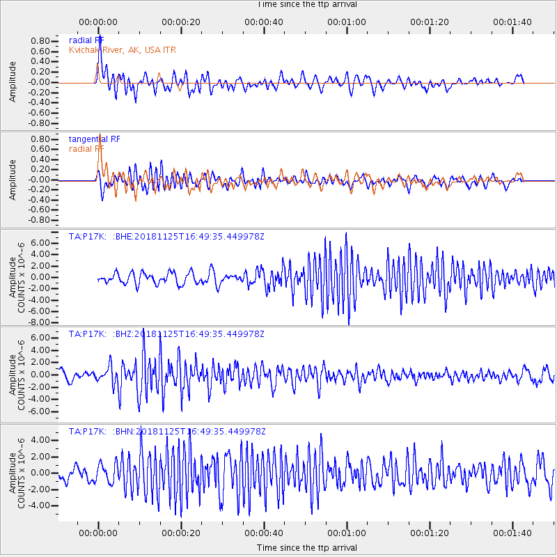
P17K Kvichak River, AK, USA - Earthquake Result Viewer
*The percent match for this event was below the threshold and hence no stack was calculated.
| Earthquake location: |
Iran-Iraq Border Region |
| Earthquake latitude/longitude: |
34.3/45.7 |
| Earthquake time(UTC): |
2018/11/25 (329) 16:37:31 GMT |
| Earthquake Depth: |
10 km |
| Earthquake Magnitude: |
6.3 Mww |
| Earthquake Catalog/Contributor: |
NEIC PDE/us |
|
| Network: |
TA USArray Transportable Network (new EarthScope stations) |
| Station: |
P17K Kvichak River, AK, USA |
| Lat/Lon: |
59.20 N/156.44 W |
| Elevation: |
91 m |
|
| Distance: |
85.0 deg |
| Az: |
11.246 deg |
| Baz: |
341.719 deg |
| Ray Param: |
$rayparam |
*The percent match for this event was below the threshold and hence was not used in the summary stack. |
|
| Radial Match: |
75.927 % |
| Radial Bump: |
400 |
| Transverse Match: |
78.805115 % |
| Transverse Bump: |
400 |
| SOD ConfigId: |
13570011 |
| Insert Time: |
2019-05-01 21:44:23.109 +0000 |
| GWidth: |
2.5 |
| Max Bumps: |
400 |
| Tol: |
0.001 |
|
Signal To Noise
| Channel | StoN | STA | LTA |
| TA:P17K: :BHZ:20181125T16:49:35.449978Z | 1.9540728 | 1.3549246E-6 | 6.9338495E-7 |
| TA:P17K: :BHN:20181125T16:49:35.449978Z | 1.206805 | 1.1700489E-6 | 9.695426E-7 |
| TA:P17K: :BHE:20181125T16:49:35.449978Z | 0.6030011 | 5.7485653E-7 | 9.5332587E-7 |
| Arrivals |
| Ps | |
| PpPs | |
| PsPs/PpSs | |


