You are here: Home > Network List > IU - Global Seismograph Network (GSN - IRIS/USGS) Stations List
> Station JOHN Johnston Island, USA > Earthquake Result Viewer
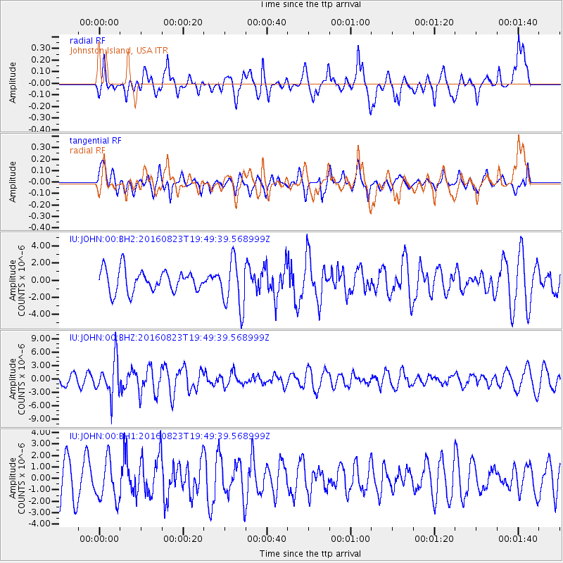
JOHN Johnston Island, USA - Earthquake Result Viewer
*The percent match for this event was below the threshold and hence no stack was calculated.
| Earthquake location: |
Flores Sea |
| Earthquake latitude/longitude: |
-7.3/122.5 |
| Earthquake time(UTC): |
2016/08/23 (236) 19:39:44 GMT |
| Earthquake Depth: |
528 km |
| Earthquake Magnitude: |
6.0 MB |
| Earthquake Catalog/Contributor: |
NEIC PDE/NEIC COMCAT |
|
| Network: |
IU Global Seismograph Network (GSN - IRIS/USGS) |
| Station: |
JOHN Johnston Island, USA |
| Lat/Lon: |
16.73 N/169.53 W |
| Elevation: |
2.0 m |
|
| Distance: |
71.4 deg |
| Az: |
69.68 deg |
| Baz: |
256.144 deg |
| Ray Param: |
$rayparam |
*The percent match for this event was below the threshold and hence was not used in the summary stack. |
|
| Radial Match: |
60.531536 % |
| Radial Bump: |
400 |
| Transverse Match: |
59.634167 % |
| Transverse Bump: |
400 |
| SOD ConfigId: |
1634031 |
| Insert Time: |
2016-09-06 19:41:42.497 +0000 |
| GWidth: |
2.5 |
| Max Bumps: |
400 |
| Tol: |
0.001 |
|
Signal To Noise
| Channel | StoN | STA | LTA |
| IU:JOHN:00:BHZ:20160823T19:49:39.568999Z | 2.8457506 | 4.0721125E-6 | 1.430945E-6 |
| IU:JOHN:00:BH1:20160823T19:49:39.568999Z | 1.4213394 | 1.792457E-6 | 1.2611041E-6 |
| IU:JOHN:00:BH2:20160823T19:49:39.568999Z | 2.3041356 | 2.9552841E-6 | 1.2825999E-6 |
| Arrivals |
| Ps | |
| PpPs | |
| PsPs/PpSs | |


