You are here: Home > Network List > TA - USArray Transportable Network (new EarthScope stations) Stations List
> Station F21K Alatna River, AK, USA > Earthquake Result Viewer
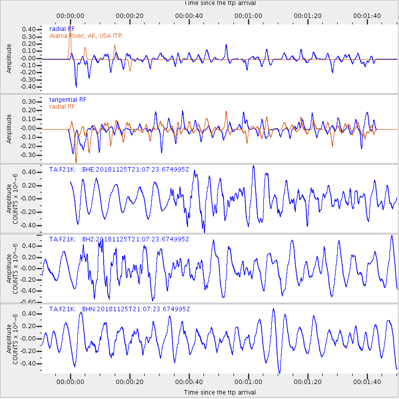
F21K Alatna River, AK, USA - Earthquake Result Viewer
*The percent match for this event was below the threshold and hence no stack was calculated.
| Earthquake location: |
Caribbean Sea |
| Earthquake latitude/longitude: |
13.2/-81.0 |
| Earthquake time(UTC): |
2018/11/25 (329) 20:56:36 GMT |
| Earthquake Depth: |
10 km |
| Earthquake Magnitude: |
5.6 Mww |
| Earthquake Catalog/Contributor: |
NEIC PDE/us |
|
| Network: |
TA USArray Transportable Network (new EarthScope stations) |
| Station: |
F21K Alatna River, AK, USA |
| Lat/Lon: |
67.22 N/153.48 W |
| Elevation: |
597 m |
|
| Distance: |
71.2 deg |
| Az: |
336.904 deg |
| Baz: |
101.109 deg |
| Ray Param: |
$rayparam |
*The percent match for this event was below the threshold and hence was not used in the summary stack. |
|
| Radial Match: |
50.831757 % |
| Radial Bump: |
400 |
| Transverse Match: |
50.907093 % |
| Transverse Bump: |
400 |
| SOD ConfigId: |
13570011 |
| Insert Time: |
2019-05-01 21:51:46.028 +0000 |
| GWidth: |
2.5 |
| Max Bumps: |
400 |
| Tol: |
0.001 |
|
Signal To Noise
| Channel | StoN | STA | LTA |
| TA:F21K: :BHZ:20181125T21:07:23.674995Z | 1.7243671 | 2.2714343E-7 | 1.3172567E-7 |
| TA:F21K: :BHN:20181125T21:07:23.674995Z | 2.412796 | 2.7951347E-7 | 1.1584629E-7 |
| TA:F21K: :BHE:20181125T21:07:23.674995Z | 0.7404174 | 1.2648515E-7 | 1.7082951E-7 |
| Arrivals |
| Ps | |
| PpPs | |
| PsPs/PpSs | |


