You are here: Home > Network List > CI - Caltech Regional Seismic Network Stations List
> Station DAN Danby, California, USA > Earthquake Result Viewer
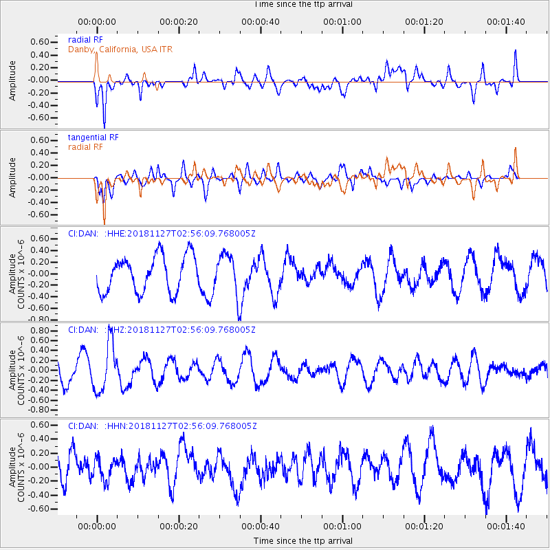
DAN Danby, California, USA - Earthquake Result Viewer
*The percent match for this event was below the threshold and hence no stack was calculated.
| Earthquake location: |
Fiji Islands Region |
| Earthquake latitude/longitude: |
-17.9/-178.6 |
| Earthquake time(UTC): |
2018/11/27 (331) 02:45:32 GMT |
| Earthquake Depth: |
568 km |
| Earthquake Magnitude: |
5.6 Mww |
| Earthquake Catalog/Contributor: |
NEIC PDE/us |
|
| Network: |
CI Caltech Regional Seismic Network |
| Station: |
DAN Danby, California, USA |
| Lat/Lon: |
34.64 N/115.38 W |
| Elevation: |
398 m |
|
| Distance: |
79.5 deg |
| Az: |
48.446 deg |
| Baz: |
239.796 deg |
| Ray Param: |
$rayparam |
*The percent match for this event was below the threshold and hence was not used in the summary stack. |
|
| Radial Match: |
72.53243 % |
| Radial Bump: |
400 |
| Transverse Match: |
58.014317 % |
| Transverse Bump: |
400 |
| SOD ConfigId: |
13570011 |
| Insert Time: |
2019-05-01 22:02:20.328 +0000 |
| GWidth: |
2.5 |
| Max Bumps: |
400 |
| Tol: |
0.001 |
|
Signal To Noise
| Channel | StoN | STA | LTA |
| CI:DAN: :HHZ:20181127T02:56:09.768005Z | 1.9314348 | 4.999066E-7 | 2.5882656E-7 |
| CI:DAN: :HHN:20181127T02:56:09.768005Z | 0.5717503 | 1.5585833E-7 | 2.725986E-7 |
| CI:DAN: :HHE:20181127T02:56:09.768005Z | 1.1698706 | 3.5948173E-7 | 3.0728333E-7 |
| Arrivals |
| Ps | |
| PpPs | |
| PsPs/PpSs | |


