You are here: Home > Network List > TA - USArray Transportable Network (new EarthScope stations) Stations List
> Station K15K Wolf Creek Mountain, AK, USA > Earthquake Result Viewer
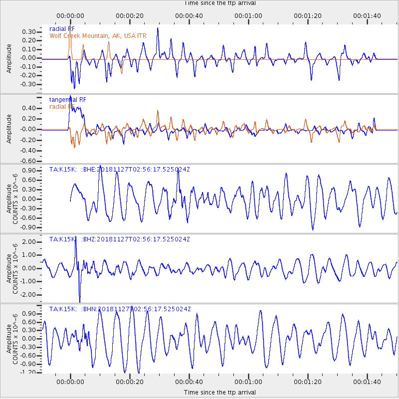
K15K Wolf Creek Mountain, AK, USA - Earthquake Result Viewer
*The percent match for this event was below the threshold and hence no stack was calculated.
| Earthquake location: |
Fiji Islands Region |
| Earthquake latitude/longitude: |
-17.9/-178.6 |
| Earthquake time(UTC): |
2018/11/27 (331) 02:45:32 GMT |
| Earthquake Depth: |
568 km |
| Earthquake Magnitude: |
5.6 Mww |
| Earthquake Catalog/Contributor: |
NEIC PDE/us |
|
| Network: |
TA USArray Transportable Network (new EarthScope stations) |
| Station: |
K15K Wolf Creek Mountain, AK, USA |
| Lat/Lon: |
62.29 N/161.53 W |
| Elevation: |
346 m |
|
| Distance: |
81.0 deg |
| Az: |
7.97 deg |
| Baz: |
196.408 deg |
| Ray Param: |
$rayparam |
*The percent match for this event was below the threshold and hence was not used in the summary stack. |
|
| Radial Match: |
57.07294 % |
| Radial Bump: |
309 |
| Transverse Match: |
55.50691 % |
| Transverse Bump: |
400 |
| SOD ConfigId: |
13570011 |
| Insert Time: |
2019-05-01 22:06:02.508 +0000 |
| GWidth: |
2.5 |
| Max Bumps: |
400 |
| Tol: |
0.001 |
|
Signal To Noise
| Channel | StoN | STA | LTA |
| TA:K15K: :BHZ:20181127T02:56:17.525024Z | 1.7959346 | 9.52808E-7 | 5.3053606E-7 |
| TA:K15K: :BHN:20181127T02:56:17.525024Z | 0.4213067 | 2.3342102E-7 | 5.5404064E-7 |
| TA:K15K: :BHE:20181127T02:56:17.525024Z | 0.7038164 | 3.2043042E-7 | 4.5527557E-7 |
| Arrivals |
| Ps | |
| PpPs | |
| PsPs/PpSs | |


