You are here: Home > Network List > PF - Volcanologic Network of Piton de Fournaise-OVPF Stations List
> Station GPS Grandes Pentes Sud > Earthquake Result Viewer
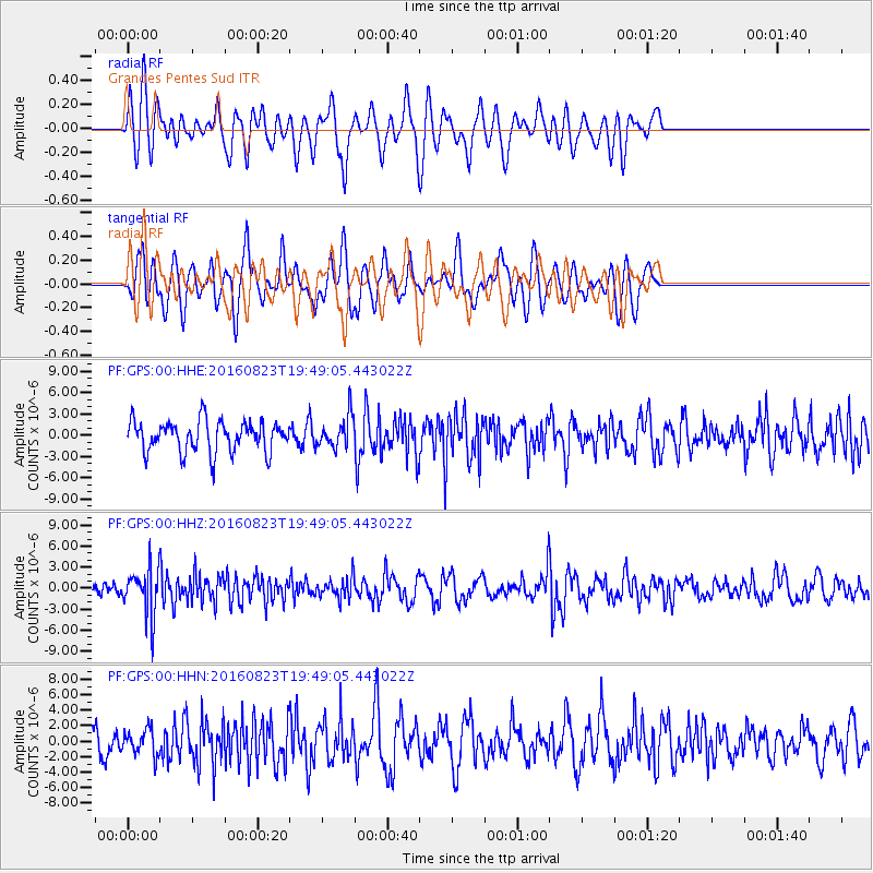
GPS Grandes Pentes Sud - Earthquake Result Viewer
*The percent match for this event was below the threshold and hence no stack was calculated.
| Earthquake location: |
Flores Sea |
| Earthquake latitude/longitude: |
-7.3/122.5 |
| Earthquake time(UTC): |
2016/08/23 (236) 19:39:44 GMT |
| Earthquake Depth: |
528 km |
| Earthquake Magnitude: |
6.0 MB |
| Earthquake Catalog/Contributor: |
NEIC PDE/NEIC COMCAT |
|
| Network: |
PF Volcanologic Network of Piton de Fournaise-OVPF |
| Station: |
GPS Grandes Pentes Sud |
| Lat/Lon: |
21.27 S/55.76 E |
| Elevation: |
1004 m |
|
| Distance: |
65.7 deg |
| Az: |
250.03 deg |
| Baz: |
88.485 deg |
| Ray Param: |
$rayparam |
*The percent match for this event was below the threshold and hence was not used in the summary stack. |
|
| Radial Match: |
55.414276 % |
| Radial Bump: |
400 |
| Transverse Match: |
52.45267 % |
| Transverse Bump: |
400 |
| SOD ConfigId: |
1634031 |
| Insert Time: |
2016-09-06 19:43:30.908 +0000 |
| GWidth: |
2.5 |
| Max Bumps: |
400 |
| Tol: |
0.001 |
|
Signal To Noise
| Channel | StoN | STA | LTA |
| PF:GPS:00:HHZ:20160823T19:49:05.443022Z | 4.206147 | 3.292353E-6 | 7.82748E-7 |
| PF:GPS:00:HHN:20160823T19:49:05.443022Z | 0.95270264 | 1.6686508E-6 | 1.7514918E-6 |
| PF:GPS:00:HHE:20160823T19:49:05.443022Z | 1.01308 | 2.1891137E-6 | 2.1608498E-6 |
| Arrivals |
| Ps | |
| PpPs | |
| PsPs/PpSs | |


