You are here: Home > Network List > CN - Canadian National Seismograph Network Stations List
> Station INK INUVIK, NT > Earthquake Result Viewer
INK INUVIK, NT - Earthquake Result Viewer
*The percent match for this event was below the threshold and hence no stack was calculated.
| Earthquake location: |
Revilla Gigedo Islands Region |
| Earthquake latitude/longitude: |
19.4/-108.4 |
| Earthquake time(UTC): |
2018/11/27 (331) 05:37:59 GMT |
| Earthquake Depth: |
10 km |
| Earthquake Magnitude: |
5.5 Mww |
| Earthquake Catalog/Contributor: |
NEIC PDE/us |
|
| Network: |
CN Canadian National Seismograph Network |
| Station: |
INK INUVIK, NT |
| Lat/Lon: |
68.31 N/133.53 W |
| Elevation: |
44 m |
|
| Distance: |
51.4 deg |
| Az: |
348.337 deg |
| Baz: |
149.111 deg |
| Ray Param: |
$rayparam |
*The percent match for this event was below the threshold and hence was not used in the summary stack. |
|
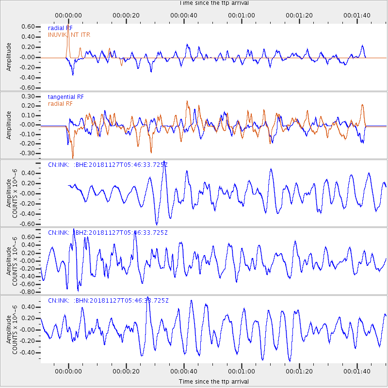
| Radial Match: |
69.646355 % |
| Radial Bump: |
400 |
| Transverse Match: |
40.49395 % |
| Transverse Bump: |
400 |
| SOD ConfigId: |
13570011 |
| Insert Time: |
2019-05-01 22:10:10.808 +0000 |
| GWidth: |
2.5 |
| Max Bumps: |
400 |
| Tol: |
0.001 |
|
Signal To Noise
| Channel | StoN | STA | LTA |
| CN:INK: :BHZ:20181127T05:46:33.725Z | 2.2137744 | 5.1326793E-7 | 2.3185196E-7 |
| CN:INK: :BHN:20181127T05:46:33.725Z | 0.67957634 | 1.5783222E-7 | 2.322509E-7 |
| CN:INK: :BHE:20181127T05:46:33.725Z | 3.6275237 | 3.7497037E-7 | 1.0336814E-7 |
| Arrivals |
| Ps | |
| PpPs | |
| PsPs/PpSs | |


