R21A Cimarron, CO, USA - Earthquake Result Viewer
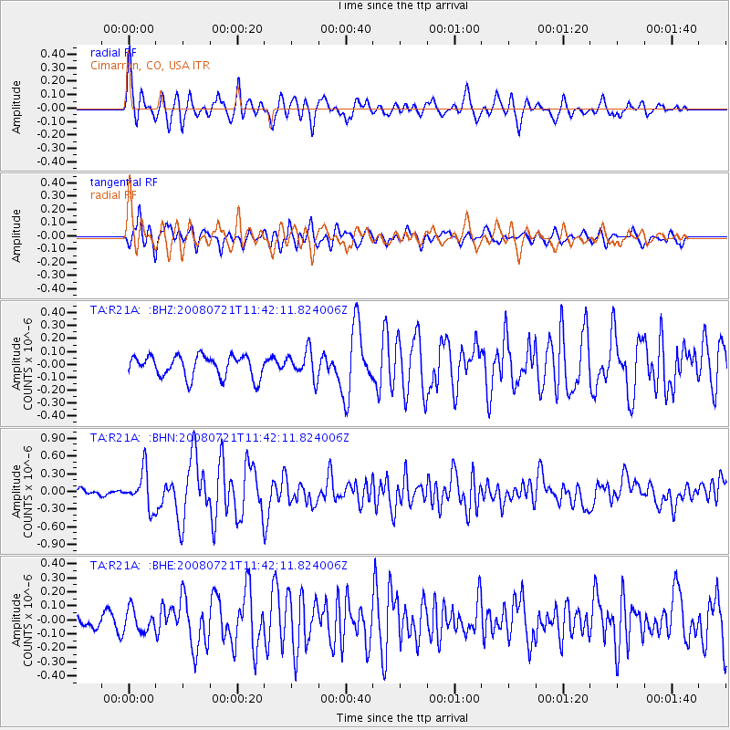
Earthquake location: Off East Coast Of Honshu, Japan
Earthquake latitude/longitude: 37.2/142.1
Earthquake time(UTC): 2008/07/21 (203) 11:30:29 GMT
Earthquake Depth: 22 km
Earthquake Magnitude: 5.7 MB, 5.6 MS, 6.0 MW, 5.9 MW
Earthquake Catalog/Contributor: WHDF/NEIC
Network: TA USArray Transportable Network (new EarthScope stations)
Station: R21A Cimarron, CO, USA
Lat/Lon: 38.37 N/107.55 W
Elevation: 2260 m
Distance: 81.2 deg
Az: 48.208 deg
Baz: 310.757 deg
Ray Param: 0.047740567
Estimated Moho Depth: 46.5 km
Estimated Crust Vp/Vs: 1.83
Assumed Crust Vp: 6.306 km/s
Estimated Crust Vs: 3.446 km/s
Estimated Crust Poisson's Ratio: 0.29
Radial Match: 81.0118 %
Radial Bump: 400
Transverse Match: 75.28596 %
Transverse Bump: 400
SOD ConfigId: 2504
Insert Time: 2010-03-06 18:15:16.172 +0000
GWidth: 2.5
Max Bumps: 400
Tol: 0.001

Signal To Noise

ChannelStoNSTALTA
TA:R21A: :BHN:20080721T11:42:11.824006Z4.73441933.1183978E-76.586653E-8
TA:R21A: :BHE:20080721T11:42:11.824006Z1.10424737.943883E-87.193934E-8
TA:R21A: :BHZ:20080721T11:42:11.824006Z1.29294371.0767596E-78.3279694E-8
Arrivals
Ps6.3 SECOND
PpPs20 SECOND
PsPs/PpSs27 SECOND