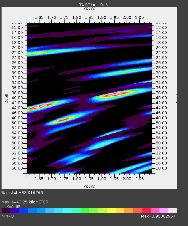
R21A Cimarron, CO, USA - Earthquake Result Viewer
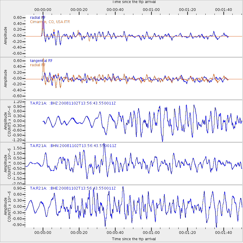
Earthquake location: Andreanof Islands, Aleutian Is.
Earthquake latitude/longitude: 51.6/-174.4
Earthquake time(UTC): 2008/11/02 (307) 13:48:42 GMT
Earthquake Depth: 36 km
Earthquake Magnitude: 5.7 MB, 5.8 MS, 6.1 MW, 6.1 MW
Earthquake Catalog/Contributor: WHDF/NEIC
Network: TA USArray Transportable Network (new EarthScope stations)
Station: R21A Cimarron, CO, USA
Lat/Lon: 38.37 N/107.55 W
Elevation: 2260 m
Distance: 47.5 deg
Az: 78.712 deg
Baz: 308.837 deg
Ray Param: 0.06989862
Estimated Moho Depth: 43.25 km
Estimated Crust Vp/Vs: 1.65
Assumed Crust Vp: 6.306 km/s
Estimated Crust Vs: 3.822 km/s
Estimated Crust Poisson's Ratio: 0.21
Radial Match: 83.016266 %
Radial Bump: 400
Transverse Match: 71.03619 %
Transverse Bump: 400
SOD ConfigId: 2658
Insert Time: 2010-03-06 18:15:30.142 +0000
GWidth: 2.5
Max Bumps: 400
Tol: 0.001

Signal To Noise

ChannelStoNSTALTA
TA:R21A: :BHN:20081102T13:56:43.550011Z2.83355625.3702587E-71.8952363E-7
TA:R21A: :BHE:20081102T13:56:43.550011Z1.19638932.5043587E-72.093264E-7
TA:R21A: :BHZ:20081102T13:56:43.550011Z2.44532734.1725252E-71.7063259E-7
Arrivals
Ps4.7 SECOND
PpPs17 SECOND
PsPs/PpSs22 SECOND