R21A Cimarron, CO, USA - Earthquake Result Viewer
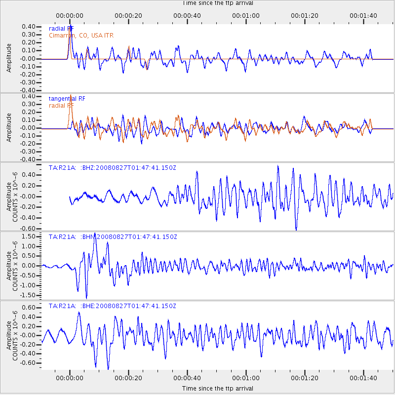
Earthquake location: Lake Baykal Region, Russia
Earthquake latitude/longitude: 51.6/104.2
Earthquake time(UTC): 2008/08/27 (240) 01:35:32 GMT
Earthquake Depth: 16 km
Earthquake Magnitude: 5.8 MB, 6.2 MS, 6.2 MW, 6.2 MW
Earthquake Catalog/Contributor: WHDF/NEIC
Network: TA USArray Transportable Network (new EarthScope stations)
Station: R21A Cimarron, CO, USA
Lat/Lon: 38.37 N/107.55 W
Elevation: 2260 m
Distance: 86.2 deg
Az: 24.46 deg
Baz: 340.823 deg
Ray Param: 0.04420777
Estimated Moho Depth: 69.75 km
Estimated Crust Vp/Vs: 1.84
Assumed Crust Vp: 6.306 km/s
Estimated Crust Vs: 3.432 km/s
Estimated Crust Poisson's Ratio: 0.29
Radial Match: 84.63894 %
Radial Bump: 400
Transverse Match: 80.8982 %
Transverse Bump: 400
SOD ConfigId: 2504
Insert Time: 2010-03-06 18:15:34.541 +0000
GWidth: 2.5
Max Bumps: 400
Tol: 0.001

Signal To Noise

ChannelStoNSTALTA
TA:R21A: :BHN:20080827T01:47:41.150Z7.8905024.7733045E-76.049431E-8
TA:R21A: :BHE:20080827T01:47:41.150Z3.62696242.2936611E-76.323918E-8
TA:R21A: :BHZ:20080827T01:47:41.150Z1.6120251.01208855E-76.278368E-8
Arrivals
Ps9.5 SECOND
PpPs31 SECOND
PsPs/PpSs40 SECOND