You are here: Home > Network List > TA - USArray Transportable Network (new EarthScope stations) Stations List
> Station O18K Koktuh Hills, AK, USA > Earthquake Result Viewer
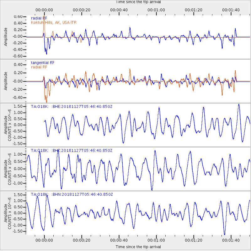
O18K Koktuh Hills, AK, USA - Earthquake Result Viewer
*The percent match for this event was below the threshold and hence no stack was calculated.
| Earthquake location: |
Revilla Gigedo Islands Region |
| Earthquake latitude/longitude: |
19.4/-108.4 |
| Earthquake time(UTC): |
2018/11/27 (331) 05:37:59 GMT |
| Earthquake Depth: |
10 km |
| Earthquake Magnitude: |
5.5 Mww |
| Earthquake Catalog/Contributor: |
NEIC PDE/us |
|
| Network: |
TA USArray Transportable Network (new EarthScope stations) |
| Station: |
O18K Koktuh Hills, AK, USA |
| Lat/Lon: |
59.85 N/155.21 W |
| Elevation: |
544 m |
|
| Distance: |
52.4 deg |
| Az: |
332.304 deg |
| Baz: |
119.605 deg |
| Ray Param: |
$rayparam |
*The percent match for this event was below the threshold and hence was not used in the summary stack. |
|
| Radial Match: |
66.0764 % |
| Radial Bump: |
387 |
| Transverse Match: |
42.090225 % |
| Transverse Bump: |
400 |
| SOD ConfigId: |
13570011 |
| Insert Time: |
2019-05-01 22:13:50.549 +0000 |
| GWidth: |
2.5 |
| Max Bumps: |
400 |
| Tol: |
0.001 |
|
Signal To Noise
| Channel | StoN | STA | LTA |
| TA:O18K: :BHZ:20181127T05:46:40.850Z | 1.4724969 | 5.797781E-7 | 3.9373808E-7 |
| TA:O18K: :BHN:20181127T05:46:40.850Z | 2.0366778 | 1.0188712E-6 | 5.0026136E-7 |
| TA:O18K: :BHE:20181127T05:46:40.850Z | 0.9383316 | 4.718871E-7 | 5.0290015E-7 |
| Arrivals |
| Ps | |
| PpPs | |
| PsPs/PpSs | |


