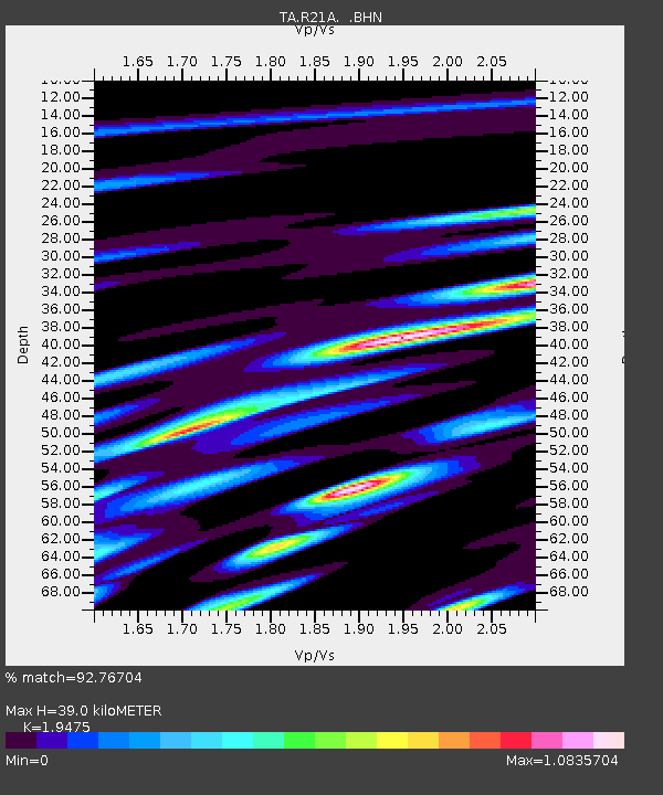
R21A Cimarron, CO, USA - Earthquake Result Viewer

Earthquake location: Rat Islands, Aleutian Islands
Earthquake latitude/longitude: 50.4/177.0
Earthquake time(UTC): 2009/07/06 (187) 14:53:12 GMT
Earthquake Depth: 22 km
Earthquake Magnitude: 6.0 MB, 5.8 MS, 6.1 MW, 6.0 MW
Earthquake Catalog/Contributor: WHDF/NEIC
Network: TA USArray Transportable Network (new EarthScope stations)
Station: R21A Cimarron, CO, USA
Lat/Lon: 38.37 N/107.55 W
Elevation: 2260 m
Distance: 53.0 deg
Az: 72.249 deg
Baz: 309.212 deg
Ray Param: 0.06634516
Estimated Moho Depth: 39.0 km
Estimated Crust Vp/Vs: 1.95
Assumed Crust Vp: 6.306 km/s
Estimated Crust Vs: 3.238 km/s
Estimated Crust Poisson's Ratio: 0.32
Radial Match: 92.76704 %
Radial Bump: 400
Transverse Match: 86.60283 %
Transverse Bump: 400
SOD ConfigId: 2648
Insert Time: 2010-03-06 18:16:47.122 +0000
GWidth: 2.5
Max Bumps: 400
Tol: 0.001

Signal To Noise

ChannelStoNSTALTA
TA:R21A: :BHN:20090706T15:01:56.50001Z14.1112521.770126E-61.2544075E-7
TA:R21A: :BHE:20090706T15:01:56.50001Z4.54615936.2548787E-71.3758601E-7
TA:R21A: :BHZ:20090706T15:01:56.50001Z7.8200189.264984E-71.18477786E-7
Arrivals
Ps6.1 SECOND
PpPs17 SECOND
PsPs/PpSs24 SECOND