You are here: Home > Network List > UW - Pacific Northwest Regional Seismic Network Stations List
> Station WOLL Wollman Farm, Schrag, WA, USA > Earthquake Result Viewer
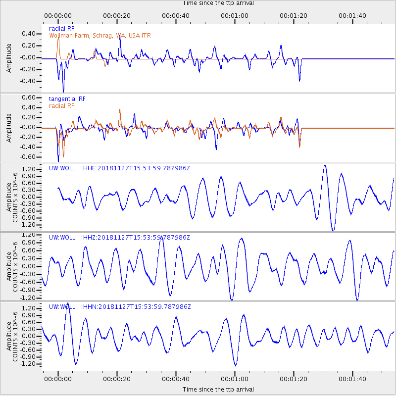
WOLL Wollman Farm, Schrag, WA, USA - Earthquake Result Viewer
*The percent match for this event was below the threshold and hence no stack was calculated.
| Earthquake location: |
Southeast Of Loyalty Islands |
| Earthquake latitude/longitude: |
-21.3/171.3 |
| Earthquake time(UTC): |
2018/11/27 (331) 15:41:20 GMT |
| Earthquake Depth: |
10 km |
| Earthquake Magnitude: |
5.8 Mww |
| Earthquake Catalog/Contributor: |
NEIC PDE/us |
|
| Network: |
UW Pacific Northwest Regional Seismic Network |
| Station: |
WOLL Wollman Farm, Schrag, WA, USA |
| Lat/Lon: |
47.06 N/118.92 W |
| Elevation: |
385 m |
|
| Distance: |
92.5 deg |
| Az: |
39.941 deg |
| Baz: |
241.09 deg |
| Ray Param: |
$rayparam |
*The percent match for this event was below the threshold and hence was not used in the summary stack. |
|
| Radial Match: |
58.954662 % |
| Radial Bump: |
326 |
| Transverse Match: |
50.53562 % |
| Transverse Bump: |
387 |
| SOD ConfigId: |
13570011 |
| Insert Time: |
2019-05-01 22:36:54.976 +0000 |
| GWidth: |
2.5 |
| Max Bumps: |
400 |
| Tol: |
0.001 |
|
Signal To Noise
| Channel | StoN | STA | LTA |
| UW:WOLL: :HHZ:20181127T15:53:59.787986Z | 0.60260296 | 2.3265237E-7 | 3.8607902E-7 |
| UW:WOLL: :HHN:20181127T15:53:59.787986Z | 2.2890086 | 7.759083E-7 | 3.3897132E-7 |
| UW:WOLL: :HHE:20181127T15:53:59.787986Z | 0.91552025 | 2.347233E-7 | 2.5638244E-7 |
| Arrivals |
| Ps | |
| PpPs | |
| PsPs/PpSs | |


