You are here: Home > Network List > TS - TERRAscope (Southern California Seismic Network) Stations List
> Station BAR Barrett Dam, California, USA > Earthquake Result Viewer
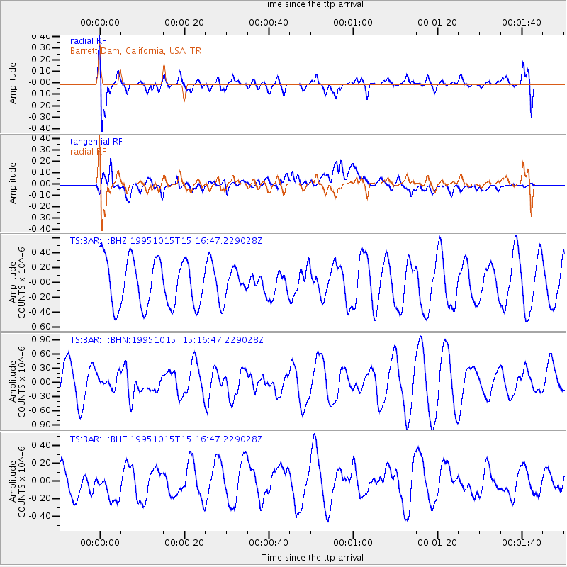
BAR Barrett Dam, California, USA - Earthquake Result Viewer
*The percent match for this event was below the threshold and hence no stack was calculated.
| Earthquake location: |
Solomon Islands |
| Earthquake latitude/longitude: |
-6.5/154.5 |
| Earthquake time(UTC): |
1995/10/15 (288) 15:04:13 GMT |
| Earthquake Depth: |
52 km |
| Earthquake Magnitude: |
5.3 MB, 5.9 MS, 5.9 UNKNOWN, 6.1 MW |
| Earthquake Catalog/Contributor: |
WHDF/NEIC |
|
| Network: |
TS TERRAscope (Southern California Seismic Network) |
| Station: |
BAR Barrett Dam, California, USA |
| Lat/Lon: |
32.68 N/116.67 W |
| Elevation: |
548 m |
|
| Distance: |
92.5 deg |
| Az: |
57.559 deg |
| Baz: |
263.874 deg |
| Ray Param: |
$rayparam |
*The percent match for this event was below the threshold and hence was not used in the summary stack. |
|
| Radial Match: |
58.513336 % |
| Radial Bump: |
400 |
| Transverse Match: |
56.70772 % |
| Transverse Bump: |
400 |
| SOD ConfigId: |
4480 |
| Insert Time: |
2010-02-26 14:01:11.030 +0000 |
| GWidth: |
2.5 |
| Max Bumps: |
400 |
| Tol: |
0.001 |
|
Signal To Noise
| Channel | StoN | STA | LTA |
| TS:BAR: :BHN:19951015T15:16:47.229028Z | 0.5370157 | 1.4480617E-7 | 2.6964977E-7 |
| TS:BAR: :BHE:19951015T15:16:47.229028Z | 1.2001004 | 2.5702158E-7 | 2.1416673E-7 |
| TS:BAR: :BHZ:19951015T15:16:47.229028Z | 0.57742673 | 1.787069E-7 | 3.0948846E-7 |
| Arrivals |
| Ps | |
| PpPs | |
| PsPs/PpSs | |


