R21A Cimarron, CO, USA - Earthquake Result Viewer
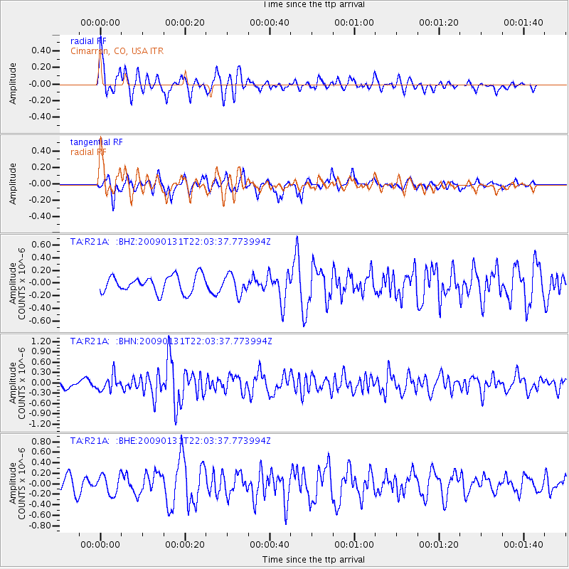
Earthquake location: Near East Coast Of Honshu, Japan
Earthquake latitude/longitude: 36.7/141.1
Earthquake time(UTC): 2009/01/31 (031) 21:51:52 GMT
Earthquake Depth: 34 km
Earthquake Magnitude: 5.6 MB, 5.3 MS, 5.8 MW, 5.7 MW
Earthquake Catalog/Contributor: WHDF/NEIC
Network: TA USArray Transportable Network (new EarthScope stations)
Station: R21A Cimarron, CO, USA
Lat/Lon: 38.37 N/107.55 W
Elevation: 2260 m
Distance: 82.0 deg
Az: 47.688 deg
Baz: 310.897 deg
Ray Param: 0.047119558
Estimated Moho Depth: 44.25 km
Estimated Crust Vp/Vs: 1.83
Assumed Crust Vp: 6.306 km/s
Estimated Crust Vs: 3.446 km/s
Estimated Crust Poisson's Ratio: 0.29
Radial Match: 81.7674 %
Radial Bump: 400
Transverse Match: 68.64237 %
Transverse Bump: 352
SOD ConfigId: 2658
Insert Time: 2010-03-06 18:17:10.289 +0000
GWidth: 2.5
Max Bumps: 400
Tol: 0.001

Signal To Noise

ChannelStoNSTALTA
TA:R21A: :BHN:20090131T22:03:37.773994Z2.32765942.1969414E-79.438414E-8
TA:R21A: :BHE:20090131T22:03:37.773994Z1.29068171.8383831E-71.4243504E-7
TA:R21A: :BHZ:20090131T22:03:37.773994Z1.18091921.550476E-71.3129402E-7
Arrivals
Ps6.0 SECOND
PpPs19 SECOND
PsPs/PpSs25 SECOND