You are here: Home > Network List > CI - Caltech Regional Seismic Network Stations List
> Station BFS Mt Baldy Forest Station > Earthquake Result Viewer
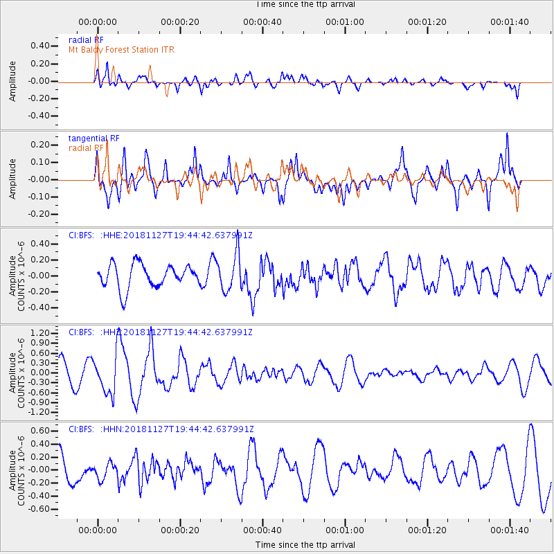
BFS Mt Baldy Forest Station - Earthquake Result Viewer
*The percent match for this event was below the threshold and hence no stack was calculated.
| Earthquake location: |
North Atlantic Ocean |
| Earthquake latitude/longitude: |
15.6/-49.9 |
| Earthquake time(UTC): |
2018/11/27 (331) 19:34:46 GMT |
| Earthquake Depth: |
10 km |
| Earthquake Magnitude: |
5.5 Mww |
| Earthquake Catalog/Contributor: |
NEIC PDE/us |
|
| Network: |
CI Caltech Regional Seismic Network |
| Station: |
BFS Mt Baldy Forest Station |
| Lat/Lon: |
34.24 N/117.66 W |
| Elevation: |
1312 m |
|
| Distance: |
63.1 deg |
| Az: |
300.739 deg |
| Baz: |
88.915 deg |
| Ray Param: |
$rayparam |
*The percent match for this event was below the threshold and hence was not used in the summary stack. |
|
| Radial Match: |
61.96958 % |
| Radial Bump: |
400 |
| Transverse Match: |
69.19973 % |
| Transverse Bump: |
400 |
| SOD ConfigId: |
13570011 |
| Insert Time: |
2019-05-01 22:39:44.977 +0000 |
| GWidth: |
2.5 |
| Max Bumps: |
400 |
| Tol: |
0.001 |
|
Signal To Noise
| Channel | StoN | STA | LTA |
| CI:BFS: :HHZ:20181127T19:44:42.637991Z | 2.0123954 | 5.9095345E-7 | 2.9365674E-7 |
| CI:BFS: :HHN:20181127T19:44:42.637991Z | 0.6377821 | 1.2945222E-7 | 2.029725E-7 |
| CI:BFS: :HHE:20181127T19:44:42.637991Z | 1.5919057 | 2.3326567E-7 | 1.4653233E-7 |
| Arrivals |
| Ps | |
| PpPs | |
| PsPs/PpSs | |


