You are here: Home > Network List > CN - Canadian National Seismograph Network Stations List
> Station INK INUVIK, NT > Earthquake Result Viewer
INK INUVIK, NT - Earthquake Result Viewer
*The percent match for this event was below the threshold and hence no stack was calculated.
| Earthquake location: |
North Atlantic Ocean |
| Earthquake latitude/longitude: |
15.6/-49.9 |
| Earthquake time(UTC): |
2018/11/27 (331) 19:34:46 GMT |
| Earthquake Depth: |
10 km |
| Earthquake Magnitude: |
5.5 Mww |
| Earthquake Catalog/Contributor: |
NEIC PDE/us |
|
| Network: |
CN Canadian National Seismograph Network |
| Station: |
INK INUVIK, NT |
| Lat/Lon: |
68.31 N/133.53 W |
| Elevation: |
44 m |
|
| Distance: |
73.3 deg |
| Az: |
337.307 deg |
| Baz: |
90.003 deg |
| Ray Param: |
$rayparam |
*The percent match for this event was below the threshold and hence was not used in the summary stack. |
|
| Radial Match: |
45.467667 % |
| Radial Bump: |
400 |
| Transverse Match: |
67.565796 % |
| Transverse Bump: |
400 |
| SOD ConfigId: |
13570011 |
| Insert Time: |
2019-05-01 22:40:32.099 +0000 |
| GWidth: |
2.5 |
| Max Bumps: |
400 |
| Tol: |
0.001 |
|
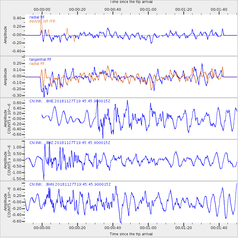
Signal To Noise
| Channel | StoN | STA | LTA |
| CN:INK: :BHZ:20181127T19:45:45.900015Z | 2.85347 | 6.4156427E-7 | 2.248365E-7 |
| CN:INK: :BHN:20181127T19:45:45.900015Z | 1.3168347 | 2.1375847E-7 | 1.6232748E-7 |
| CN:INK: :BHE:20181127T19:45:45.900015Z | 2.105847 | 3.3854943E-7 | 1.607664E-7 |
| Arrivals |
| Ps | |
| PpPs | |
| PsPs/PpSs | |


