R21A Cimarron, CO, USA - Earthquake Result Viewer
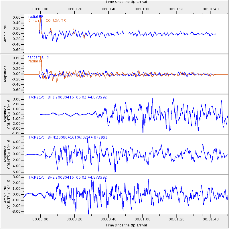
Earthquake location: Andreanof Islands, Aleutian Is.
Earthquake latitude/longitude: 51.9/-179.2
Earthquake time(UTC): 2008/04/16 (107) 05:54:19 GMT
Earthquake Depth: 13 km
Earthquake Magnitude: 6.1 MB, 6.5 MS, 6.6 MW, 6.6 MW
Earthquake Catalog/Contributor: WHDF/NEIC
Network: TA USArray Transportable Network (new EarthScope stations)
Station: R21A Cimarron, CO, USA
Lat/Lon: 38.37 N/107.55 W
Elevation: 2260 m
Distance: 50.3 deg
Az: 75.807 deg
Baz: 310.133 deg
Ray Param: 0.06814094
Estimated Moho Depth: 38.25 km
Estimated Crust Vp/Vs: 1.99
Assumed Crust Vp: 6.306 km/s
Estimated Crust Vs: 3.177 km/s
Estimated Crust Poisson's Ratio: 0.33
Radial Match: 93.0745 %
Radial Bump: 400
Transverse Match: 84.95381 %
Transverse Bump: 400
SOD ConfigId: 2504
Insert Time: 2010-03-06 18:17:23.379 +0000
GWidth: 2.5
Max Bumps: 400
Tol: 0.001

Signal To Noise

ChannelStoNSTALTA
TA:R21A: :BHN:20080416T06:02:44.87399Z6.1221867.452182E-71.217242E-7
TA:R21A: :BHE:20080416T06:02:44.87399Z1.9761673.2662942E-71.6528432E-7
TA:R21A: :BHZ:20080416T06:02:44.87399Z2.0425263.144494E-71.5395123E-7
Arrivals
Ps6.3 SECOND
PpPs17 SECOND
PsPs/PpSs24 SECOND