You are here: Home > Network List > TA - USArray Transportable Network (new EarthScope stations) Stations List
> Station 833A Chaparral WMA, Artesia Wells, TX, USA > Earthquake Result Viewer
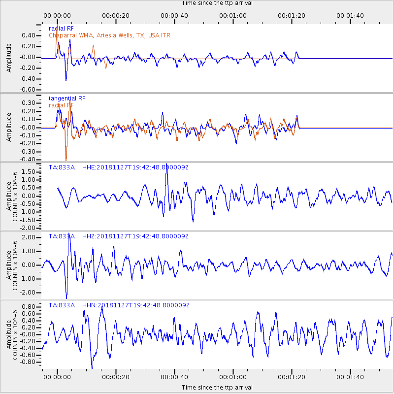
833A Chaparral WMA, Artesia Wells, TX, USA - Earthquake Result Viewer
*The percent match for this event was below the threshold and hence no stack was calculated.
| Earthquake location: |
North Atlantic Ocean |
| Earthquake latitude/longitude: |
15.6/-49.9 |
| Earthquake time(UTC): |
2018/11/27 (331) 19:34:46 GMT |
| Earthquake Depth: |
10 km |
| Earthquake Magnitude: |
5.5 Mww |
| Earthquake Catalog/Contributor: |
NEIC PDE/us |
|
| Network: |
TA USArray Transportable Network (new EarthScope stations) |
| Station: |
833A Chaparral WMA, Artesia Wells, TX, USA |
| Lat/Lon: |
28.32 N/99.39 W |
| Elevation: |
171 m |
|
| Distance: |
47.3 deg |
| Az: |
294.251 deg |
| Baz: |
94.685 deg |
| Ray Param: |
$rayparam |
*The percent match for this event was below the threshold and hence was not used in the summary stack. |
|
| Radial Match: |
61.792343 % |
| Radial Bump: |
249 |
| Transverse Match: |
57.514484 % |
| Transverse Bump: |
310 |
| SOD ConfigId: |
13570011 |
| Insert Time: |
2019-05-01 22:45:20.807 +0000 |
| GWidth: |
2.5 |
| Max Bumps: |
400 |
| Tol: |
0.001 |
|
Signal To Noise
| Channel | StoN | STA | LTA |
| TA:833A: :HHZ:20181127T19:42:48.800009Z | 5.3919926 | 1.0939079E-6 | 2.0287636E-7 |
| TA:833A: :HHN:20181127T19:42:48.800009Z | 0.6469856 | 1.2429392E-7 | 1.9211235E-7 |
| TA:833A: :HHE:20181127T19:42:48.800009Z | 1.7907559 | 4.4330628E-7 | 2.475526E-7 |
| Arrivals |
| Ps | |
| PpPs | |
| PsPs/PpSs | |


