You are here: Home > Network List > TA - USArray Transportable Network (new EarthScope stations) Stations List
> Station D25K Kavik River, AK, USA > Earthquake Result Viewer
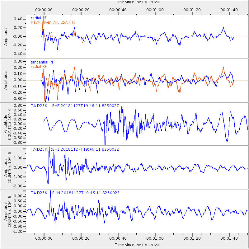
D25K Kavik River, AK, USA - Earthquake Result Viewer
*The percent match for this event was below the threshold and hence no stack was calculated.
| Earthquake location: |
North Atlantic Ocean |
| Earthquake latitude/longitude: |
15.6/-49.9 |
| Earthquake time(UTC): |
2018/11/27 (331) 19:34:46 GMT |
| Earthquake Depth: |
10 km |
| Earthquake Magnitude: |
5.5 Mww |
| Earthquake Catalog/Contributor: |
NEIC PDE/us |
|
| Network: |
TA USArray Transportable Network (new EarthScope stations) |
| Station: |
D25K Kavik River, AK, USA |
| Lat/Lon: |
69.32 N/146.38 W |
| Elevation: |
770 m |
|
| Distance: |
77.8 deg |
| Az: |
338.835 deg |
| Baz: |
78.407 deg |
| Ray Param: |
$rayparam |
*The percent match for this event was below the threshold and hence was not used in the summary stack. |
|
| Radial Match: |
67.5062 % |
| Radial Bump: |
400 |
| Transverse Match: |
76.29144 % |
| Transverse Bump: |
400 |
| SOD ConfigId: |
13570011 |
| Insert Time: |
2019-05-01 22:45:33.898 +0000 |
| GWidth: |
2.5 |
| Max Bumps: |
400 |
| Tol: |
0.001 |
|
Signal To Noise
| Channel | StoN | STA | LTA |
| TA:D25K: :BHZ:20181127T19:46:11.825002Z | 4.3455787 | 8.903151E-7 | 2.0487839E-7 |
| TA:D25K: :BHN:20181127T19:46:11.825002Z | 3.2746277 | 3.7850597E-7 | 1.1558749E-7 |
| TA:D25K: :BHE:20181127T19:46:11.825002Z | 2.0213163 | 3.3920824E-7 | 1.6781553E-7 |
| Arrivals |
| Ps | |
| PpPs | |
| PsPs/PpSs | |


