You are here: Home > Network List > TA - USArray Transportable Network (new EarthScope stations) Stations List
> Station J20K Nowitna River, AK, USA > Earthquake Result Viewer
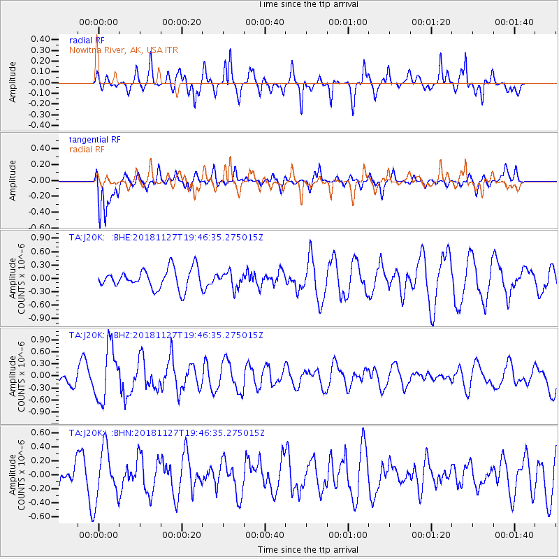
J20K Nowitna River, AK, USA - Earthquake Result Viewer
*The percent match for this event was below the threshold and hence no stack was calculated.
| Earthquake location: |
North Atlantic Ocean |
| Earthquake latitude/longitude: |
15.6/-49.9 |
| Earthquake time(UTC): |
2018/11/27 (331) 19:34:46 GMT |
| Earthquake Depth: |
10 km |
| Earthquake Magnitude: |
5.5 Mww |
| Earthquake Catalog/Contributor: |
NEIC PDE/us |
|
| Network: |
TA USArray Transportable Network (new EarthScope stations) |
| Station: |
J20K Nowitna River, AK, USA |
| Lat/Lon: |
64.18 N/154.15 W |
| Elevation: |
314 m |
|
| Distance: |
82.2 deg |
| Az: |
334.628 deg |
| Baz: |
70.533 deg |
| Ray Param: |
$rayparam |
*The percent match for this event was below the threshold and hence was not used in the summary stack. |
|
| Radial Match: |
74.26144 % |
| Radial Bump: |
375 |
| Transverse Match: |
75.49674 % |
| Transverse Bump: |
400 |
| SOD ConfigId: |
13570011 |
| Insert Time: |
2019-05-01 22:46:06.267 +0000 |
| GWidth: |
2.5 |
| Max Bumps: |
400 |
| Tol: |
0.001 |
|
Signal To Noise
| Channel | StoN | STA | LTA |
| TA:J20K: :BHZ:20181127T19:46:35.275015Z | 2.2184668 | 6.825816E-7 | 3.076817E-7 |
| TA:J20K: :BHN:20181127T19:46:35.275015Z | 1.1557182 | 3.554982E-7 | 3.0759938E-7 |
| TA:J20K: :BHE:20181127T19:46:35.275015Z | 0.8036361 | 1.8005828E-7 | 2.240545E-7 |
| Arrivals |
| Ps | |
| PpPs | |
| PsPs/PpSs | |


