You are here: Home > Network List > TA - USArray Transportable Network (new EarthScope stations) Stations List
> Station N23A Red Feather Lakes, CO, USA > Earthquake Result Viewer
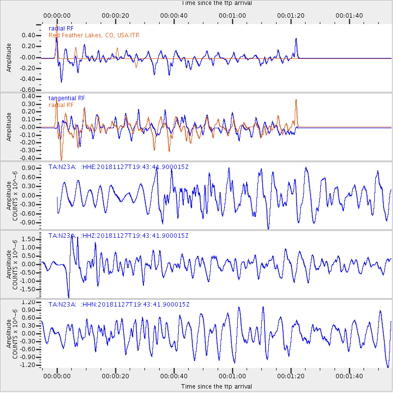
N23A Red Feather Lakes, CO, USA - Earthquake Result Viewer
*The percent match for this event was below the threshold and hence no stack was calculated.
| Earthquake location: |
North Atlantic Ocean |
| Earthquake latitude/longitude: |
15.6/-49.9 |
| Earthquake time(UTC): |
2018/11/27 (331) 19:34:46 GMT |
| Earthquake Depth: |
10 km |
| Earthquake Magnitude: |
5.5 Mww |
| Earthquake Catalog/Contributor: |
NEIC PDE/us |
|
| Network: |
TA USArray Transportable Network (new EarthScope stations) |
| Station: |
N23A Red Feather Lakes, CO, USA |
| Lat/Lon: |
40.89 N/105.94 W |
| Elevation: |
2458 m |
|
| Distance: |
54.4 deg |
| Az: |
309.341 deg |
| Baz: |
100.533 deg |
| Ray Param: |
$rayparam |
*The percent match for this event was below the threshold and hence was not used in the summary stack. |
|
| Radial Match: |
66.14929 % |
| Radial Bump: |
400 |
| Transverse Match: |
45.303074 % |
| Transverse Bump: |
311 |
| SOD ConfigId: |
13570011 |
| Insert Time: |
2019-05-01 22:46:16.390 +0000 |
| GWidth: |
2.5 |
| Max Bumps: |
400 |
| Tol: |
0.001 |
|
Signal To Noise
| Channel | StoN | STA | LTA |
| TA:N23A: :HHZ:20181127T19:43:41.900015Z | 1.9151765 | 7.5111615E-7 | 3.9219162E-7 |
| TA:N23A: :HHN:20181127T19:43:41.900015Z | 0.9196084 | 2.6372754E-7 | 2.8678244E-7 |
| TA:N23A: :HHE:20181127T19:43:41.900015Z | 1.7738318 | 4.671761E-7 | 2.6337113E-7 |
| Arrivals |
| Ps | |
| PpPs | |
| PsPs/PpSs | |


