You are here: Home > Network List > TA - USArray Transportable Network (new EarthScope stations) Stations List
> Station T25A Trinidad, CO, USA > Earthquake Result Viewer
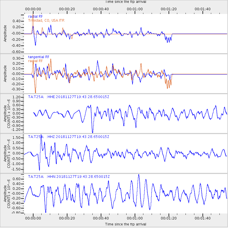
T25A Trinidad, CO, USA - Earthquake Result Viewer
*The percent match for this event was below the threshold and hence no stack was calculated.
| Earthquake location: |
North Atlantic Ocean |
| Earthquake latitude/longitude: |
15.6/-49.9 |
| Earthquake time(UTC): |
2018/11/27 (331) 19:34:46 GMT |
| Earthquake Depth: |
10 km |
| Earthquake Magnitude: |
5.5 Mww |
| Earthquake Catalog/Contributor: |
NEIC PDE/us |
|
| Network: |
TA USArray Transportable Network (new EarthScope stations) |
| Station: |
T25A Trinidad, CO, USA |
| Lat/Lon: |
37.14 N/104.41 W |
| Elevation: |
2017 m |
|
| Distance: |
52.6 deg |
| Az: |
304.993 deg |
| Baz: |
98.907 deg |
| Ray Param: |
$rayparam |
*The percent match for this event was below the threshold and hence was not used in the summary stack. |
|
| Radial Match: |
56.14793 % |
| Radial Bump: |
276 |
| Transverse Match: |
42.879375 % |
| Transverse Bump: |
340 |
| SOD ConfigId: |
13570011 |
| Insert Time: |
2019-05-01 22:46:26.118 +0000 |
| GWidth: |
2.5 |
| Max Bumps: |
400 |
| Tol: |
0.001 |
|
Signal To Noise
| Channel | StoN | STA | LTA |
| TA:T25A: :HHZ:20181127T19:43:28.650015Z | 2.5112808 | 7.315855E-7 | 2.9131968E-7 |
| TA:T25A: :HHN:20181127T19:43:28.650015Z | 0.4465224 | 1.216922E-7 | 2.7253324E-7 |
| TA:T25A: :HHE:20181127T19:43:28.650015Z | 3.4370399 | 5.544472E-7 | 1.6131531E-7 |
| Arrivals |
| Ps | |
| PpPs | |
| PsPs/PpSs | |


