You are here: Home > Network List > CN - Canadian National Seismograph Network Stations List
> Station INK INUVIK, NT > Earthquake Result Viewer
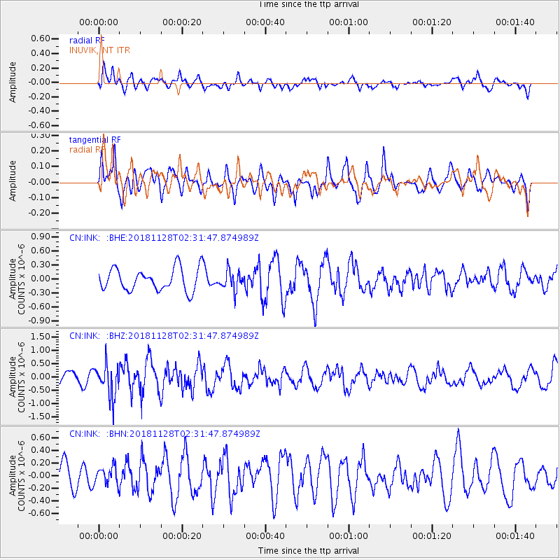
INK INUVIK, NT - Earthquake Result Viewer
*The percent match for this event was below the threshold and hence no stack was calculated.
| Earthquake location: |
Hokkaido, Japan Region |
| Earthquake latitude/longitude: |
41.4/143.3 |
| Earthquake time(UTC): |
2018/11/28 (332) 02:23:24 GMT |
| Earthquake Depth: |
10 km |
| Earthquake Magnitude: |
5.5 Mww |
| Earthquake Catalog/Contributor: |
NEIC PDE/us |
|
| Network: |
CN Canadian National Seismograph Network |
| Station: |
INK INUVIK, NT |
| Lat/Lon: |
68.31 N/133.53 W |
| Elevation: |
44 m |
|
| Distance: |
49.9 deg |
| Az: |
28.857 deg |
| Baz: |
282.229 deg |
| Ray Param: |
$rayparam |
*The percent match for this event was below the threshold and hence was not used in the summary stack. |
|
| Radial Match: |
56.355366 % |
| Radial Bump: |
400 |
| Transverse Match: |
52.948883 % |
| Transverse Bump: |
400 |
| SOD ConfigId: |
13570011 |
| Insert Time: |
2019-05-01 22:51:52.168 +0000 |
| GWidth: |
2.5 |
| Max Bumps: |
400 |
| Tol: |
0.001 |
|
Signal To Noise
| Channel | StoN | STA | LTA |
| CN:INK: :BHZ:20181128T02:31:47.874989Z | 3.052822 | 6.0893467E-7 | 1.9946614E-7 |
| CN:INK: :BHN:20181128T02:31:47.874989Z | 0.6851027 | 1.3745918E-7 | 2.0064026E-7 |
| CN:INK: :BHE:20181128T02:31:47.874989Z | 0.8880833 | 2.0264912E-7 | 2.2818708E-7 |
| Arrivals |
| Ps | |
| PpPs | |
| PsPs/PpSs | |


