You are here: Home > Network List > TA - USArray Transportable Network (new EarthScope stations) Stations List
> Station R21A Cimarron, CO, USA > Earthquake Result Viewer
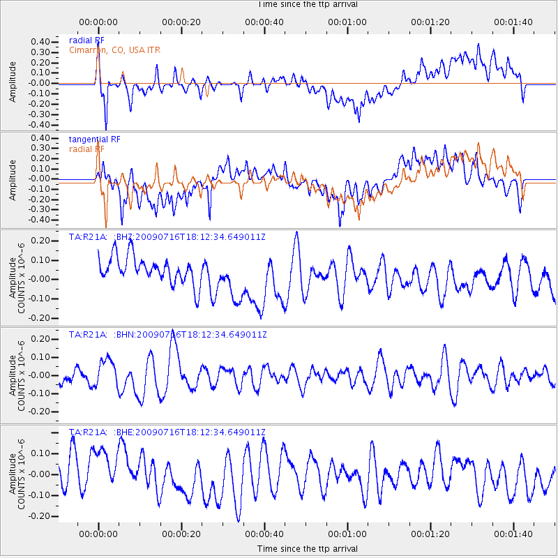
R21A Cimarron, CO, USA - Earthquake Result Viewer
*The percent match for this event was below the threshold and hence no stack was calculated.
| Earthquake location: |
Vanuatu Islands |
| Earthquake latitude/longitude: |
-17.5/167.7 |
| Earthquake time(UTC): |
2009/07/16 (197) 17:59:36 GMT |
| Earthquake Depth: |
10 km |
| Earthquake Magnitude: |
5.8 MW, 5.4 MS, 5.4 MB, 5.8 MW |
| Earthquake Catalog/Contributor: |
WHDF/NEIC |
|
| Network: |
TA USArray Transportable Network (new EarthScope stations) |
| Station: |
R21A Cimarron, CO, USA |
| Lat/Lon: |
38.37 N/107.55 W |
| Elevation: |
2260 m |
|
| Distance: |
96.7 deg |
| Az: |
52.006 deg |
| Baz: |
253.05 deg |
| Ray Param: |
$rayparam |
*The percent match for this event was below the threshold and hence was not used in the summary stack. |
|
| Radial Match: |
49.16389 % |
| Radial Bump: |
400 |
| Transverse Match: |
49.75994 % |
| Transverse Bump: |
400 |
| SOD ConfigId: |
2648 |
| Insert Time: |
2010-03-06 18:19:09.805 +0000 |
| GWidth: |
2.5 |
| Max Bumps: |
400 |
| Tol: |
0.001 |
|
Signal To Noise
| Channel | StoN | STA | LTA |
| TA:R21A: :BHN:20090716T18:12:34.649011Z | 1.4331365 | 7.7795896E-8 | 5.4283664E-8 |
| TA:R21A: :BHE:20090716T18:12:34.649011Z | 1.6353233 | 1.1785867E-7 | 7.2070556E-8 |
| TA:R21A: :BHZ:20090716T18:12:34.649011Z | 1.7650886 | 1.1957755E-7 | 6.7745916E-8 |
| Arrivals |
| Ps | |
| PpPs | |
| PsPs/PpSs | |


