You are here: Home > Network List > TA - USArray Transportable Network (new EarthScope stations) Stations List
> Station E18K Tukpahlearik Creek, AK, USA > Earthquake Result Viewer
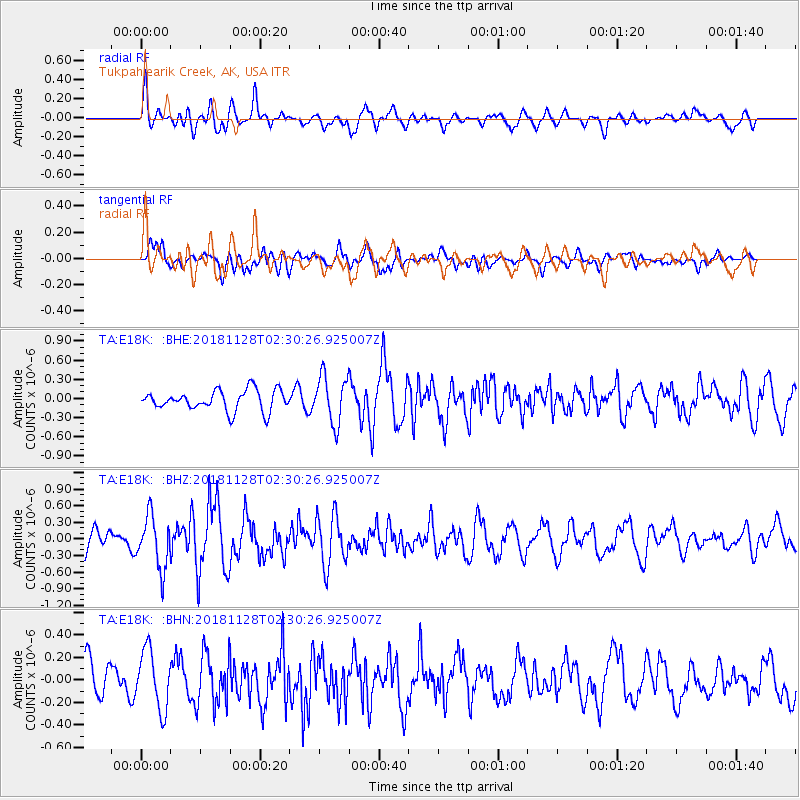
E18K Tukpahlearik Creek, AK, USA - Earthquake Result Viewer
*The percent match for this event was below the threshold and hence no stack was calculated.
| Earthquake location: |
Hokkaido, Japan Region |
| Earthquake latitude/longitude: |
41.4/143.3 |
| Earthquake time(UTC): |
2018/11/28 (332) 02:23:24 GMT |
| Earthquake Depth: |
10 km |
| Earthquake Magnitude: |
5.5 Mww |
| Earthquake Catalog/Contributor: |
NEIC PDE/us |
|
| Network: |
TA USArray Transportable Network (new EarthScope stations) |
| Station: |
E18K Tukpahlearik Creek, AK, USA |
| Lat/Lon: |
67.42 N/160.60 W |
| Elevation: |
297 m |
|
| Distance: |
39.7 deg |
| Az: |
30.112 deg |
| Baz: |
257.998 deg |
| Ray Param: |
$rayparam |
*The percent match for this event was below the threshold and hence was not used in the summary stack. |
|
| Radial Match: |
64.70218 % |
| Radial Bump: |
400 |
| Transverse Match: |
56.540497 % |
| Transverse Bump: |
400 |
| SOD ConfigId: |
13570011 |
| Insert Time: |
2019-05-01 22:57:05.123 +0000 |
| GWidth: |
2.5 |
| Max Bumps: |
400 |
| Tol: |
0.001 |
|
Signal To Noise
| Channel | StoN | STA | LTA |
| TA:E18K: :BHZ:20181128T02:30:26.925007Z | 2.1232636 | 4.6836922E-7 | 2.2058929E-7 |
| TA:E18K: :BHN:20181128T02:30:26.925007Z | 1.7359834 | 2.608607E-7 | 1.5026683E-7 |
| TA:E18K: :BHE:20181128T02:30:26.925007Z | 2.255885 | 3.6132909E-7 | 1.6017177E-7 |
| Arrivals |
| Ps | |
| PpPs | |
| PsPs/PpSs | |


