You are here: Home > Network List > TA - USArray Transportable Network (new EarthScope stations) Stations List
> Station R33M Jennings River, BC, CAN > Earthquake Result Viewer
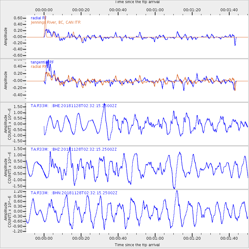
R33M Jennings River, BC, CAN - Earthquake Result Viewer
*The percent match for this event was below the threshold and hence no stack was calculated.
| Earthquake location: |
Hokkaido, Japan Region |
| Earthquake latitude/longitude: |
41.4/143.3 |
| Earthquake time(UTC): |
2018/11/28 (332) 02:23:24 GMT |
| Earthquake Depth: |
10 km |
| Earthquake Magnitude: |
5.5 Mww |
| Earthquake Catalog/Contributor: |
NEIC PDE/us |
|
| Network: |
TA USArray Transportable Network (new EarthScope stations) |
| Station: |
R33M Jennings River, BC, CAN |
| Lat/Lon: |
59.39 N/130.97 W |
| Elevation: |
1437 m |
|
| Distance: |
53.6 deg |
| Az: |
39.364 deg |
| Baz: |
291.051 deg |
| Ray Param: |
$rayparam |
*The percent match for this event was below the threshold and hence was not used in the summary stack. |
|
| Radial Match: |
40.836216 % |
| Radial Bump: |
400 |
| Transverse Match: |
71.98182 % |
| Transverse Bump: |
400 |
| SOD ConfigId: |
13570011 |
| Insert Time: |
2019-05-01 22:58:24.972 +0000 |
| GWidth: |
2.5 |
| Max Bumps: |
400 |
| Tol: |
0.001 |
|
Signal To Noise
| Channel | StoN | STA | LTA |
| TA:R33M: :BHZ:20181128T02:32:15.25002Z | 2.0393476 | 6.244379E-7 | 3.0619495E-7 |
| TA:R33M: :BHN:20181128T02:32:15.25002Z | 0.9387216 | 4.4134566E-7 | 4.7015607E-7 |
| TA:R33M: :BHE:20181128T02:32:15.25002Z | 1.6888317 | 8.778239E-7 | 5.197818E-7 |
| Arrivals |
| Ps | |
| PpPs | |
| PsPs/PpSs | |


