You are here: Home > Network List > TJ - Tajikistan National Seismic Network Stations List
> Station GARM Garm, Tajikistan > Earthquake Result Viewer
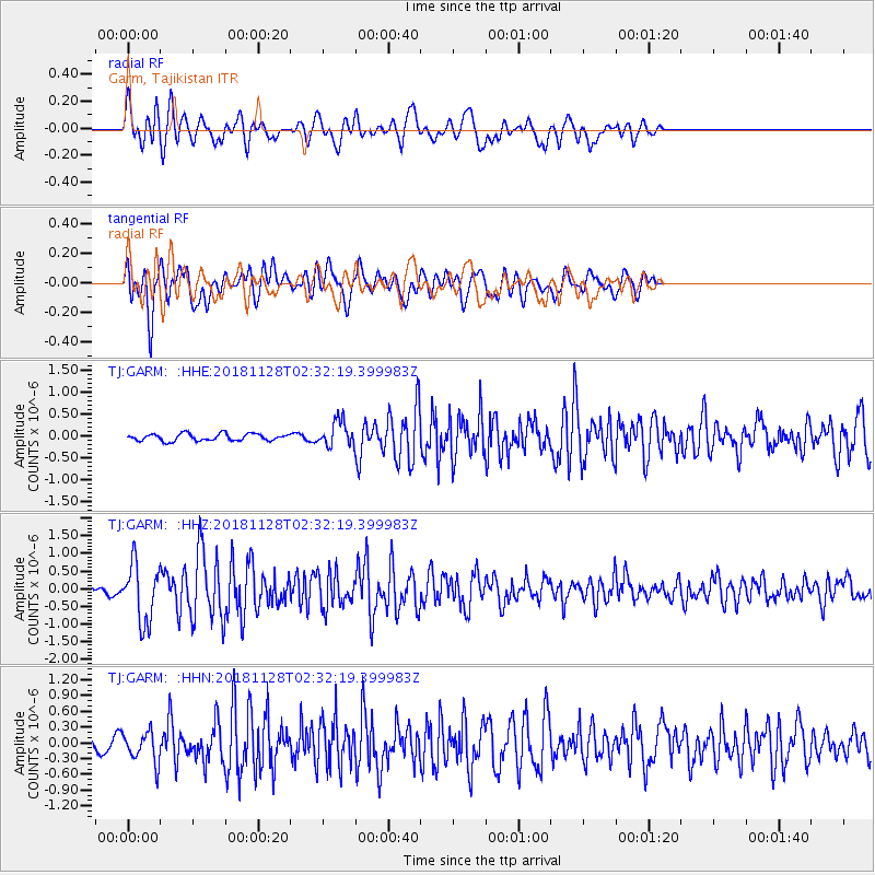
GARM Garm, Tajikistan - Earthquake Result Viewer
*The percent match for this event was below the threshold and hence no stack was calculated.
| Earthquake location: |
Hokkaido, Japan Region |
| Earthquake latitude/longitude: |
41.4/143.3 |
| Earthquake time(UTC): |
2018/11/28 (332) 02:23:24 GMT |
| Earthquake Depth: |
10 km |
| Earthquake Magnitude: |
5.5 Mww |
| Earthquake Catalog/Contributor: |
NEIC PDE/us |
|
| Network: |
TJ Tajikistan National Seismic Network |
| Station: |
GARM Garm, Tajikistan |
| Lat/Lon: |
39.00 N/70.32 E |
| Elevation: |
1305 m |
|
| Distance: |
54.2 deg |
| Az: |
293.345 deg |
| Baz: |
62.513 deg |
| Ray Param: |
$rayparam |
*The percent match for this event was below the threshold and hence was not used in the summary stack. |
|
| Radial Match: |
80.86095 % |
| Radial Bump: |
400 |
| Transverse Match: |
71.290375 % |
| Transverse Bump: |
400 |
| SOD ConfigId: |
13570011 |
| Insert Time: |
2019-05-01 22:58:32.365 +0000 |
| GWidth: |
2.5 |
| Max Bumps: |
400 |
| Tol: |
0.001 |
|
Signal To Noise
| Channel | StoN | STA | LTA |
| TJ:GARM: :HHZ:20181128T02:32:19.399983Z | 5.536971 | 8.131487E-7 | 1.4685803E-7 |
| TJ:GARM: :HHN:20181128T02:32:19.399983Z | 2.8604586 | 2.9667953E-7 | 1.0371747E-7 |
| TJ:GARM: :HHE:20181128T02:32:19.399983Z | 3.610479 | 2.8747905E-7 | 7.962352E-8 |
| Arrivals |
| Ps | |
| PpPs | |
| PsPs/PpSs | |


